Template:Featured Article/March, 2017
From CSU-CHILL

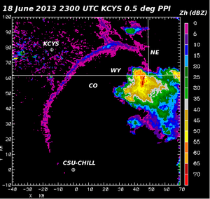
NWS Cheyenne WY (KCYS) low elevation angle reflectivity data depicts a strong thunderstorm near the intersection point of Nebraska, Wyoming, and Colorado. The leading edge of the surface outflow from this mature storm was also detected to the southeast of KCYS. Differential propagation phase data collected by the CSU-CHILL radar indicated that strong electric fields were present at upper levels of the storm. Lightning activity near this strong field signature was confirmed by data from the northern Colorado Lightning Mapping Array (LMA). (Full Article...)