Local flooding in Byers, Colorado: 7 July 2010

Overview
An intense thunderstorm line produced local flooding in Byers, Colorado during the early evening hours of 6 July 2010 (local date). CSU-CHILL low elevation angle PPI data collected during this event have been assembled into several time lapse loops.
Introduction
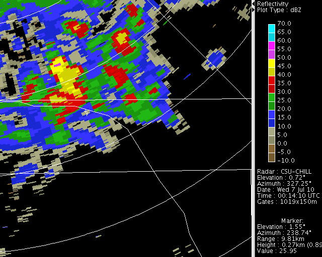
During the early evening hours of 6 July 2010 (7 July on UTC), a line of thunderstorms developed along a surface cold front that was moving through the CSU-CHILL radar's southeast azimuth quadrant. The following plot shows the reflectivity field in a low elevation angle PPI scan at 0014 UTC. Selected geographical references have been added to this plot.

The following severe weather reports were filed from the town of Byers in association with the passage of the thunderstorms. (Local MDT is six hours behind UTC; 0014 UTC is 1814 MDT):

Reflectivity loop
The PPI sequence indicates that the thunderstorm line become quasi-stationary in the Byers area between approximately 0038 and 0116 UTC (image frames 6 and 15). During this period, separate >60 dBZ reflectivity cores moving along the line axis crossed Byers at 0047 and 0059 UTC (frames 8 and 11):
|
|
||
|
loop

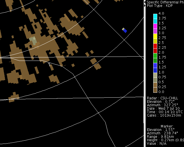
One-way specific propagation differential phase () values as large as 2 - 3 degrees per km were observed in the Byers area. In agreement with the spotter report of heavy rainfall, this implies rain rates of ~90 mm per hour. The Byers observer in the Community Collaborative Rain, Hail and Snow network (CoCoRaHS) reported that 2.25 inches of rain fell in the 24 hour period ending at 0700 MDT on 7 July.
|
|
||
|
loop

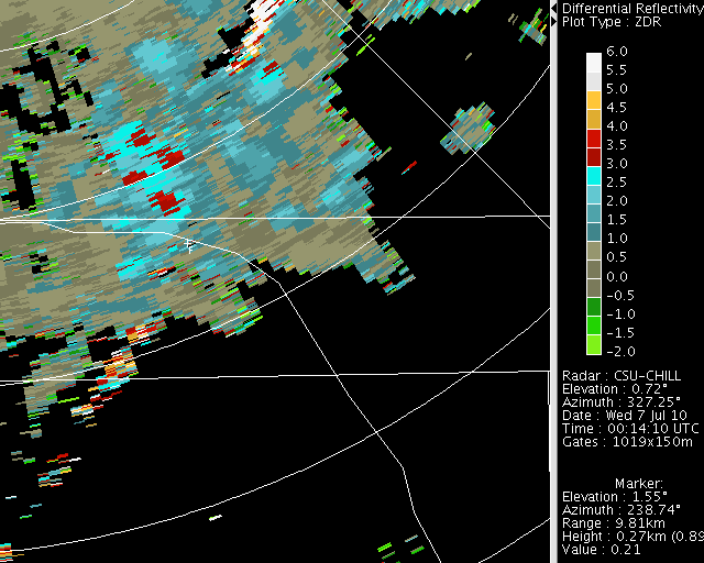
The differential reflectivity data shows that near 0 dB values existed within portions of the >50 dBZ echo region. These low Zdr values imply that the horizontally and vertically polarized received signal levels were essentially equal. In intense thunderstorm precipitation, this low is typically due to the presence of tumbling hailstones. (The spotter reports confirmed the existence of .75 inch diameter hail):
|
|
||
|