User:Jgeorge: Difference between revisions
From CSU-CHILL
m (→Articles: Added link to Digital Waveform Synthesizer) |
m (Removed google maps animation, added front end link) |
||
| Line 20: | Line 20: | ||
*[[X-band Solid State Transmitter Monitor User's Guide]] | *[[X-band Solid State Transmitter Monitor User's Guide]] | ||
*[[Digital Waveform Synthesizer User's Guide]] | *[[Digital Waveform Synthesizer User's Guide]] | ||
*[CSU-CHILL Receiver Front End]] | |||
==Google Maps marker demo== | ==Google Maps marker demo== | ||
| Line 26: | Line 27: | ||
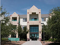
40.574595|-105.101427|Home [[Image:Ihouse outside.jpg|200px]] [http://www.housing.colostate.edu/apartments/international_house.htm International House] | 40.574595|-105.101427|Home [[Image:Ihouse outside.jpg|200px]] [http://www.housing.colostate.edu/apartments/international_house.htm International House] | ||
40.575765|-105.083123|[http://www.engr.colostate.edu/ece CSU Engineering] | 40.575765|-105.083123|[http://www.engr.colostate.edu/ece CSU Engineering] | ||
</gmap> | </gmap> | ||
Revision as of 14:08, 2 September 2009
My page. Includes test stuff, links to articles. Enjoy.
Articles
- Image loop demo
- Using calibration files with Time Series data
- Interpreting Housekeeping data
- Coherent Leakage
- Wireless Link
- Radome Status
- Radar Echoes from Wind Turbines
- Power Supply selection for RF Components (TN-005)
- Tornado Observation from May 22, 2008
- Antenna Pattern Evaluation
- Frequency Synthesizer User's Guide
- Clock Generator User's Guide
- Educational Outreach
- Network-oriented Signal Processor Architecture
- GMap demo
- Pedestal/Encoder Interface Board User's Guide
- X-band Solid State Transmitter Monitor User's Guide
- Digital Waveform Synthesizer User's Guide
- [CSU-CHILL Receiver Front End]]
Google Maps marker demo
<gmap lat="40.574595" long="-105.101427" zoom="15" width="600" height="600" showscale="on">
points:
40.574595|-105.101427|Home  International House
40.575765|-105.083123|CSU Engineering
</gmap>
Radome Status