DPWX/Surface divergence and heavy rainfall beneath a thunderstorm: 19 June 2014: Difference between revisions
From CSU-CHILL
Pat kennedy (talk | contribs) (updating plots) |
Pat kennedy (talk | contribs) No edit summary |
||
| Line 1: | Line 1: | ||
[[Image:19jun2014 0018UTC precip shaft w2000.JPG|300px|right]] | |||
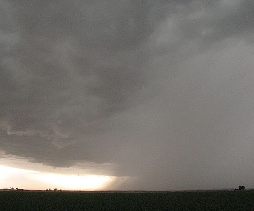
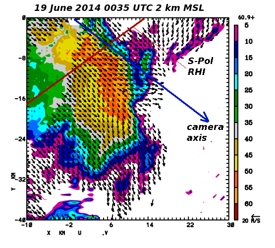
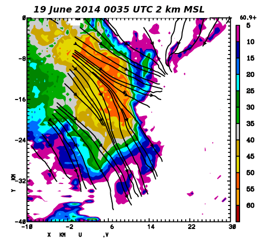
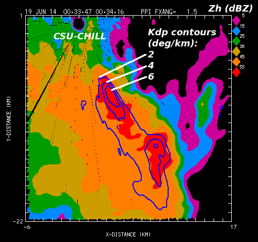
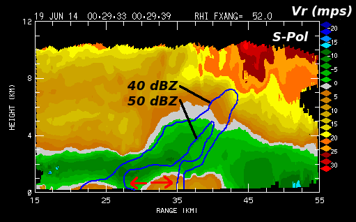
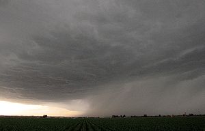
A thunderstorm's heavy precipitation area passes to the south of the CSU-CHILL radar site at 0018:39 UTC on 19 June 2014. The NCAR S-Pol and CSU-CHILL radars conducted synchronized volume scans of this storm during the North Carolina State University Radar Observations of Storms for Education (ROSE) project. A dual-Doppler synthesis of the divergent horizontal wind field that was present at low levels in this storm has been generated. | |||
[[Image:19jun2014 precip shaft crop 1200w.JPG|500px|center]] | [[Image:19jun2014 precip shaft crop 1200w.JPG|500px|center]] | ||
Revision as of 13:32, 28 August 2014
A thunderstorm's heavy precipitation area passes to the south of the CSU-CHILL radar site at 0018:39 UTC on 19 June 2014. The NCAR S-Pol and CSU-CHILL radars conducted synchronized volume scans of this storm during the North Carolina State University Radar Observations of Storms for Education (ROSE) project. A dual-Doppler synthesis of the divergent horizontal wind field that was present at low levels in this storm has been generated.
