DPWX/Snow band observations: 17 November 2015: Difference between revisions
From CSU-CHILL
Pat kennedy (talk | contribs) (Adding front page plot.) |
Pat kennedy (talk | contribs) No edit summary |
||
| Line 32: | Line 32: | ||
[[Image:17nov2015 XB 171deg RHI anot AGL.png|center]] | [[Image:17nov2015 XB 171deg RHI anot AGL.png|center]] | ||
{| | |||
| METAR element || KDEN || KGXY | |||
|- | |||
| Time UTC || 1045 || 1055 | |||
|- | |||
| Wind Direction (deg) || 350 || 340 | |||
|- | |||
| Wind speed (kt) || 31 || 28 | |||
|- | |||
| Wind gust (kt) || 41 || 42 | |||
|- | |||
| Sky || Vert. Vis. 900 ft || Overcast 7000 ft | |||
|- | |||
| Visibility (sm) || 1/2 || 10 | |||
|- | |||
| Temperature (C) || -1 || 1 | |||
|- | |||
| Dew Point (C) || -3 || -5 | |||
|- | |||
| Weather / Precip. || Moderate snow freezing fog || None | |||
|} | |||
Revision as of 07:22, 26 November 2015
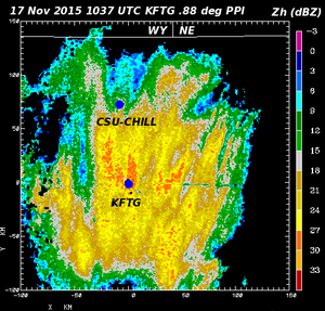
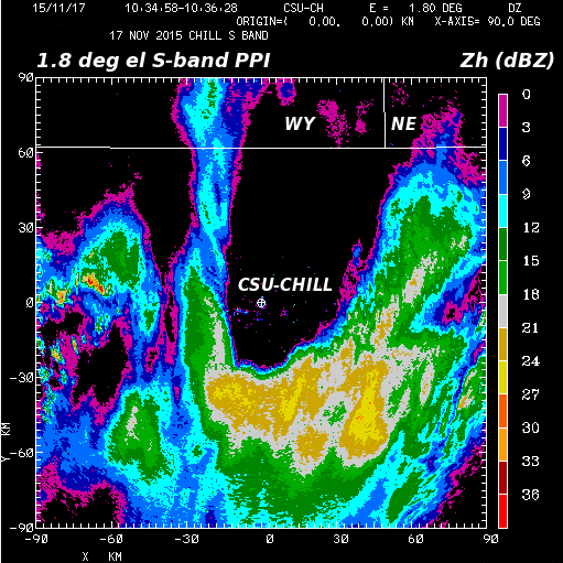
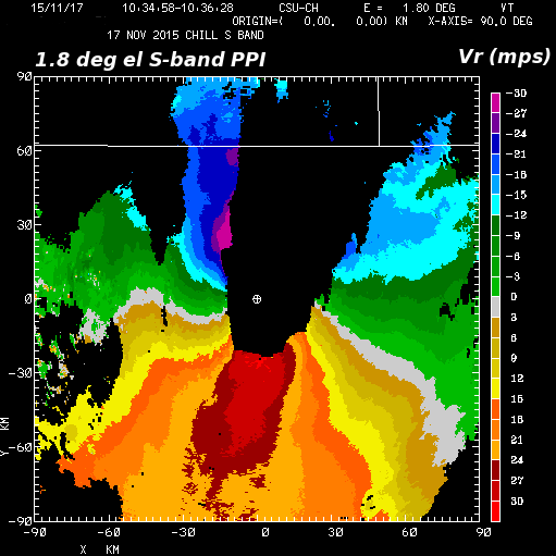
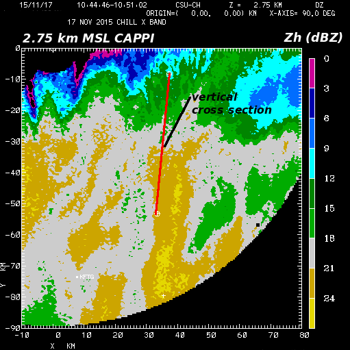
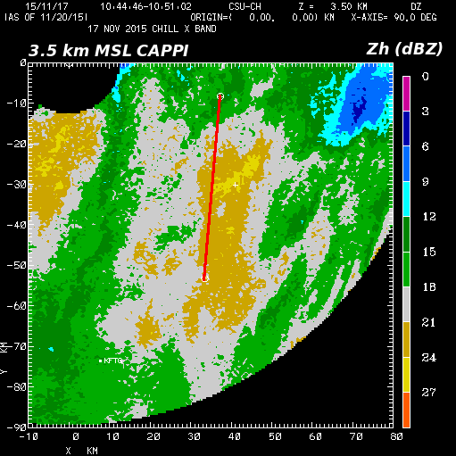
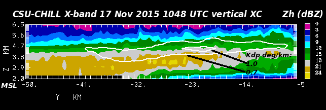
Reflectivity data from the NWS KFTG radar in a 0.88 degree elevation angle through a winter storm containing snow bands. Plots of selected CSU-CHILL radar dual-wavelength (S and X-band) observations collected from a portion of this snow band area have been prepared.

| METAR element | KDEN | KGXY |
| Time UTC | 1045 | 1055 |
| Wind Direction (deg) | 350 | 340 |
| Wind speed (kt) | 31 | 28 |
| Wind gust (kt) | 41 | 42 |
| Sky | Vert. Vis. 900 ft | Overcast 7000 ft |
| Visibility (sm) | 1/2 | 10 |
| Temperature (C) | -1 | 1 |
| Dew Point (C) | -3 | -5 |
| Weather / Precip. | Moderate snow freezing fog | None |