DPWX/Snow band observations: 17 November 2015
Author: Patrick C. Kennedy
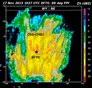
Reflectivity data from the NWS KFTG radar in a 0.88 degree elevation angle through a winter storm containing snow bands. Plots of selected CSU-CHILL radar dual-wavelength (S and X-band) observations collected from a portion of this snow band area have been prepared.
Overview
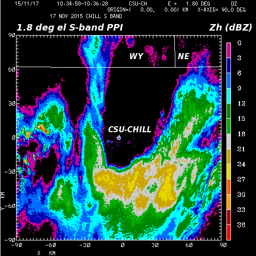
During the early morning hours of 17 November 2015 a surface low pressure system developed over southeastern Colorado. Widespread accumulating snow and strong surface winds, with blizzard conditions in some locations, were forecast to occur in much of the CSU-CHILL radar's coverage area. One period of well-organized snow band activity occurred in the southeast azimuth quadrant of the CSU-CHILL radar during the 1030 - 1100 UTC time period. The following two plots show CHILL S-band data collected in a 1.8 degree elevation angle PPI scan at 1035 UTC. At this time, the immediate CSU-CHILL / Greeley area was echo free while a northeast-southwest oriented echo band was located at a range of ~50 km southeast of the radar.
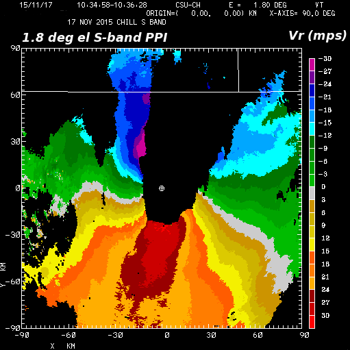
The radial velocity pattern showed north-northeasterly winds at all beam heights. This is consistent with both the surface low pressure center and supporting upper level trough axis being located east of the radar. The strongest velocities (~30 mps) were found within 2 km of the surface.
Analyses of gridded X-band data from the 1045-1051 UTC volume scan
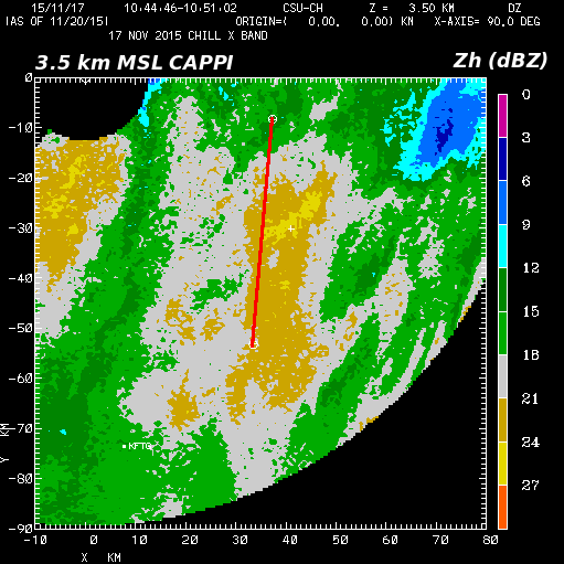
Starting at 1045 UTC, the CSU-CHILL radar conducted a PPI sector volume scan of the snow band activity in the southeast azimuth quadrant. The following two plots were generated by interpolating the X-band data from this sector volume scan to an X,Y,Z Cartesian analysis grid. The following two plots show the reflectivity fields at the 2.75 and 3.5 km MSL height levels. The CSU-CHILL radar site elevation is 1.4 km MSL. The snow band of interest is located approximately along X = 37 km. The maximum reflectivity in this band shifts northward (upwind) with height between the 2.75 and 3.5 km MSL height levels.
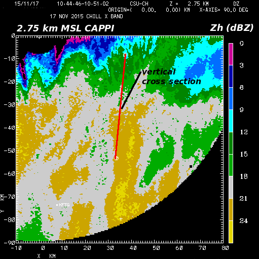
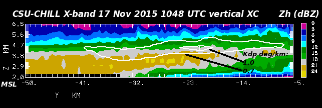
A vertical cross section along a plane rotated into approximate alignment with the snow band is shown below. (The location of this cross section is marked with a red line in the preceding CAPPI plots). The color-filled reflectivity field shows the sloping nature of reflectivity contours in the snow band. Reflectivity values increase towards the ground as the individual snow particles aggregate into larger diameter hydrometeors during their descent to the surface. The solid white overlay contours are the +0.7 and 1.0 deg / km specific propagation differential phase (Kdp) values. This maximum Kdp layer is located near the -15 deg C environmental temperature level (4260 m MSL in the Denver 12 UTC sounding). The growth of planar dendritic ice crystals is favored when saturated conditions exist at this temperature. Sufficient concentrations of these quasi-horizontally oriented dendritic crystals can generate positive Kdp values, especially at shorter radar wavelengths like X-band [Schrom et al, 2015]. As many of the individual dendritic crystals collect into irregular aggregates, their characteristic oblate shape is lost, causing the Kdp magnitudes to decrease in the higher reflectivty, lower altitude portion of the snow band.
RHI scan at 1051 UTC
Immediately after the PPI sector volume scan was completed, two RHI scans were done on azimuths of 171 and 172 degrees. The vertical reflectivity structure in the 171 degree azimuth RHI scan is shown in the following plot. The echo system that exists aloft at short ranges near the CSU-CHILL radar at Greeley does not descend to the surface until a range of ~45 km south of the radar is reached. Denver International Airport (KDEN) is located within the "impact region" of the descending snow streamer at a range of ~63 km. (The airport is located on the CHILL 184 degree azimuth, thus it is 10.6 degrees to the west of the RHI plane.)

The following table collects selected elements of the ~1050 UTC METAR surface observations taken at KDEN and Greeley (KGXY); the Greeley AWOS site is within 2 km of the CSU-CHILL radar. As suggested by the RHI data, the cloud base at Greeley was at 7,000 feet AGL with no precipitation while KDEN was experiencing moderate snow with a surface visibility of 0.5 stature miles. The down-sloping characteristic of the northerly wind flow at Greeley probably helped maintain the observed slightly above freezing surface temperatures. This sharp north-south precipitation gradient was maintained throughout most the storm. No snow accumulated at the CSU-CHILL radar site while 4 - 8 inches of wind-driven snow fell in the Denver area.
| METAR element | KDEN | KGXY |
|---|---|---|
| Time UTC | 1045 | 1055 |
| Wind Direction (deg) | 350 | 340 |
| Wind speed (kt) | 31 | 28 |
| Wind gust (kt) | 41 | 42 |
| Sky | Vert. Vis. 900 ft | Overcast 7000 ft |
| Visibility (sm) | 1/2 | 10 |
| Temperature (C) | -1 | 1 |
| Dew Point (C) | -3 | -5 |
| Weather / Precip. | Moderate snow freezing fog | None |
References
- [*Schrom et al, 2015] Robert S. Schrom, Matthew R. Kumjian, and Yinghui Lu, 2015: Polarimetric Radar Signatures of Dendritic Growth Zones within Colorado Winter Storms. J. Appl. Meteor. Climatol., 54, 2365–2388.