WXlog/20080809 Thunderstorm RHI Vr: Difference between revisions
From CSU-CHILL
Pat kennedy (talk | contribs) (Created page with "An RHI scan was made through the core of a severe thunderstorm located southeast of the CHILL radar. Maximum echo tops were ~16 km AGL (17.4 km / 57 kft MSL). The unfolded r...") |
(No difference)
|
Revision as of 06:43, 26 March 2020
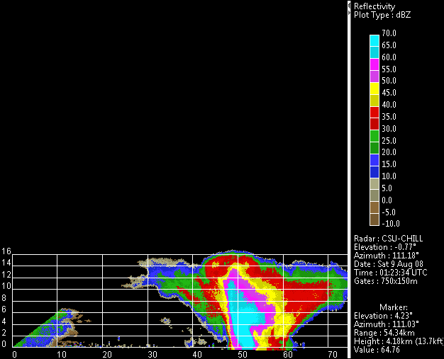
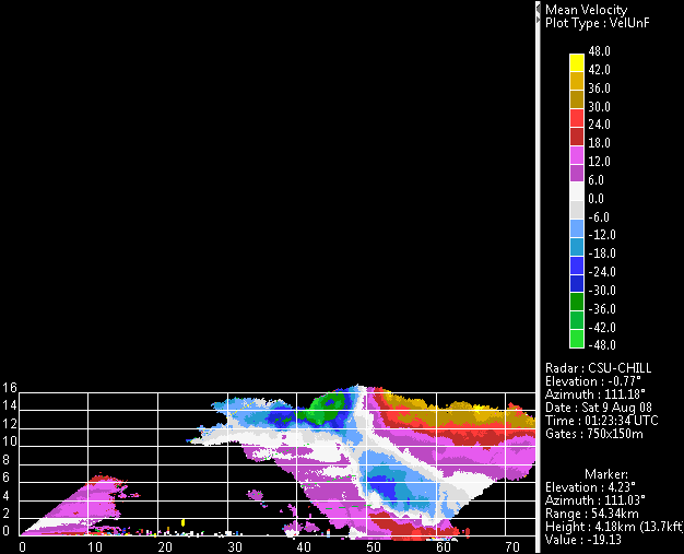
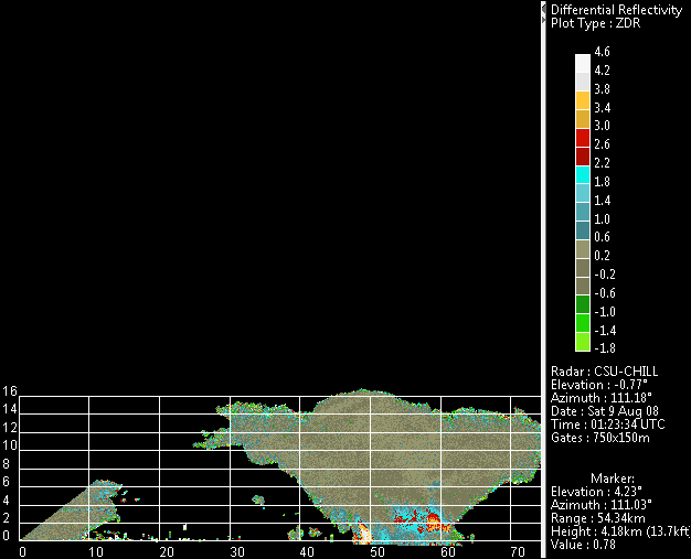
An RHI scan was made through the core of a severe thunderstorm located southeast of the CHILL radar. Maximum echo tops were ~16 km AGL (17.4 km / 57 kft MSL). The unfolded radial velocity patterns imply the existence of a sloping updraft that connects low level convergence to strong divergence centered on the echo summit. A positive Zdr column is suggested in the storm inflow area while a hail signature is seen in the echo core at near-ground heights.


