Template:Featured Image/June, 2009
From CSU-CHILL

|
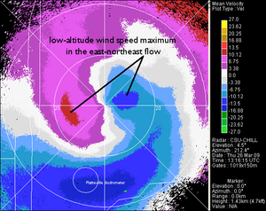
low-level radial velocity maximum Low level wind maxima are often observed in the CSU-CHILL data during deep cyclonic upslope winter precipitation events in northeast Colorado. The radial velocity pattern shown here occurred during the early stages of a blizzard on 26 March, 2009 Photo credit: Pat Kennedy |