An RHI scan through a severe thunderstorm: 21 June 2010: Difference between revisions
From CSU-CHILL
Pat kennedy (talk | contribs) (initial image posting) |
Pat kennedy (talk | contribs) No edit summary |
||
| Line 1: | Line 1: | ||
==Overview== | ==Overview== | ||
==Introduction== | ==Introduction== | ||
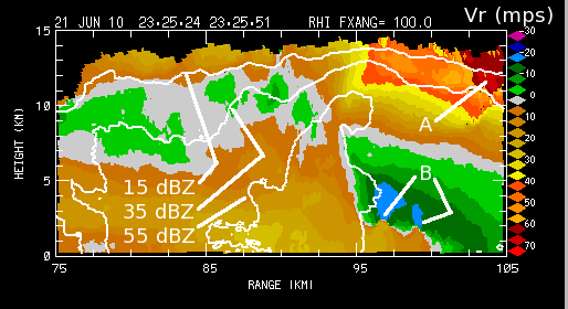
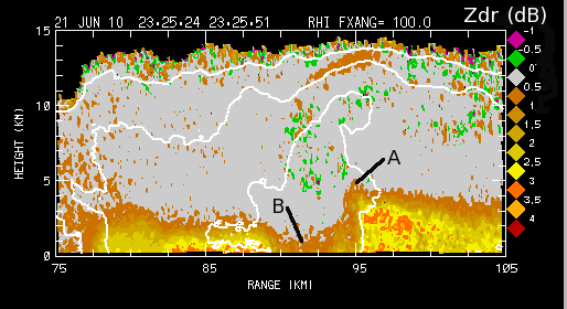
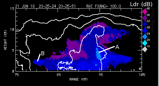
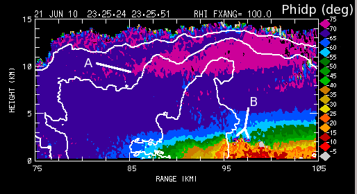
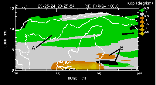
The CSU-CHILL radar observed several severe thunderstorms during the afternoon hours of 21 June 2010. At ~2330 UTC Morgan County Colorado was being affected by this activity. The severe weather reports compiled by the Storm Prediction Center include 1.5 inch diameter hail 1 mile south of Brush at 2316 UTC and 1.0 inch diameter hail and 60 mph wind gusts 5 miles northeast of Brush at 2333 UTC. An RHI volume scan in the vicinity of these severe weather reports was made at 2325 UTC. The sweep done on the 100 degree azimuth captured some notable features. | |||
==Reflectivity and radial velocity== | ==Reflectivity and radial velocity== | ||
In all of the following plots, the basic reflectivity | |||
[[Image:21jun2010 RHI vt anot.png]] | [[Image:21jun2010 RHI vt anot.png]] | ||
==Differential reflectivity== | ==Differential reflectivity== | ||
Revision as of 12:03, 21 April 2011
Overview
Introduction
The CSU-CHILL radar observed several severe thunderstorms during the afternoon hours of 21 June 2010. At ~2330 UTC Morgan County Colorado was being affected by this activity. The severe weather reports compiled by the Storm Prediction Center include 1.5 inch diameter hail 1 mile south of Brush at 2316 UTC and 1.0 inch diameter hail and 60 mph wind gusts 5 miles northeast of Brush at 2333 UTC. An RHI volume scan in the vicinity of these severe weather reports was made at 2325 UTC. The sweep done on the 100 degree azimuth captured some notable features.
Reflectivity and radial velocity
In all of the following plots, the basic reflectivity
