WXlog/20110109 Snow Bands
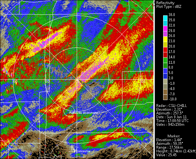
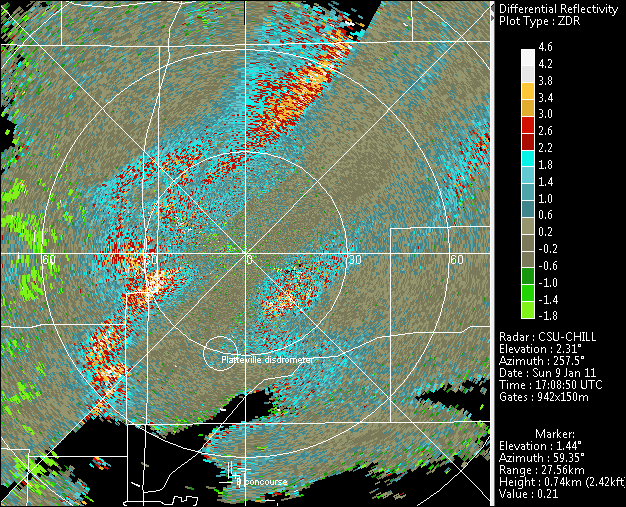
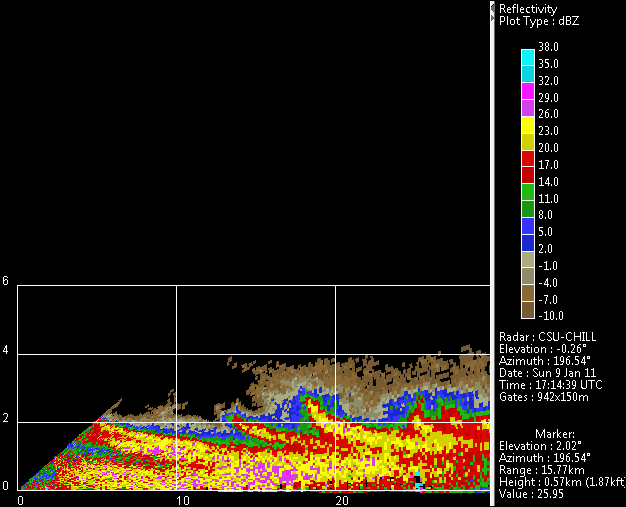
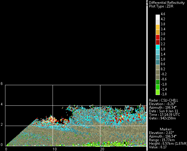
A snow band was crossing the CSU-CHILL radar site at the time of the PPI scans shown below. A period of moderate intensity snow occurred at the radar during the band passage. The corresponding Zdr image shows that Zdr values are ~0 dB in the higher reflectivity snow band areas. This is due to the many irregularly shaped, low density aggregated snow particles in the bands. In the weaker reflectivity areas between the bands, hydrometeor concentrations are low and the collisions that produce aggregation are rare. This allows more hydrometeors to remain as individual, mostly planar, ice crystals. Aerodynamic forces tend to keep the long axes of these crystal quasi-horizontally oriented as they fall. This orientation produces positive Zdr values. The data in the final two RHI images was collected on an azimuth of 196.5 degrees. The sloping, higher reflectivity precipitation trails show the impact of vertical wind shear upon the slowly-falling snow particles. Small scale generating cells near the general echo top height are the source of the precipitation trails. As in the PPI scan, Zdr's tend to be most positive in the low reflectivity, more individual ice crystal areas.


