WXlog/20150605 Tornado: Difference between revisions
From CSU-CHILL
Pat kennedy (talk | contribs) (Created page with "SPC severe storm reports identify a tornado at 0035 UTC observed 4 miles NW of Longmont on 5 June 2015. center") |
Pat kennedy (talk | contribs) No edit summary |
||
| Line 1: | Line 1: | ||
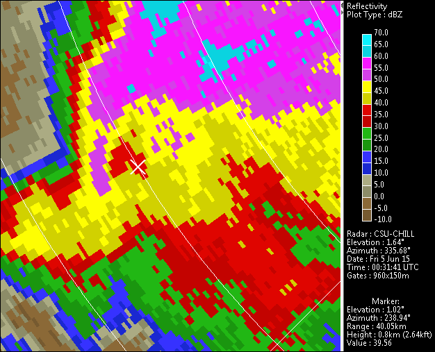
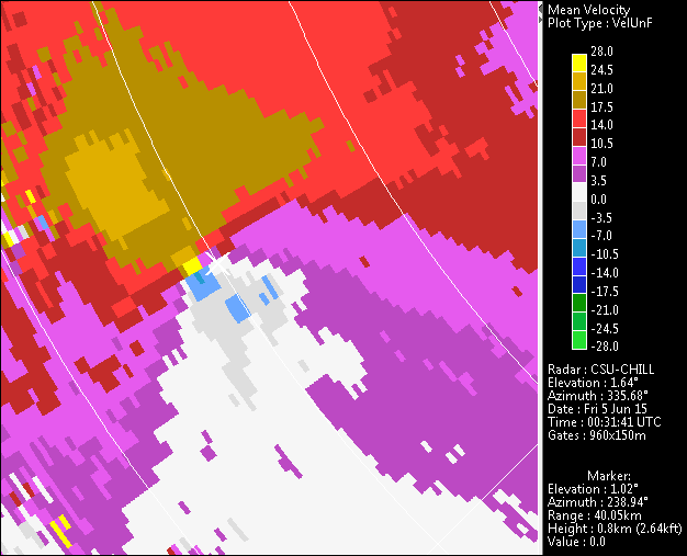
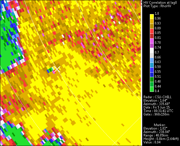
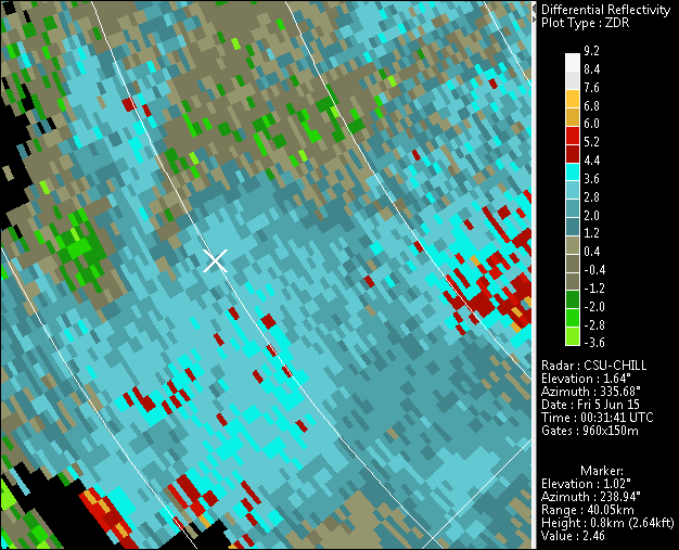
SPC severe storm reports identify a tornado at 0035 UTC observed 4 miles NW of Longmont on 5 June 2015. | SPC severe storm reports identify a tornado at 0035 UTC that was observed from 4 miles NW of Longmont on 5 June 2015. Post-storm surveys found that the primary damage occurred at a house in the Berthoud area. The PPI images shown below contain the TVS and TDS patterns observed at an early point in the tornado's lifetime. The tornado tracked essentially towards the west. Hail signatures are also present in the rhoHV and Zdr data within the reflectivity core. Range rings are at 5 km intervals. The cursor location near the tornado is on the 40 km ring. | ||
[[Image:5jun2015_Berthoud_z.png|center]] | [[Image:5jun2015_Berthoud_z.png|center]] | ||
[[Image:5jun2015_Berthoud_vuf.png|center]] | |||
[[Image:5jun2015_Berthoud_rho.png|center]] | |||
[[Image:5jun2015_Berthoud_zdr.png|center]] | |||
Latest revision as of 11:07, 2 April 2020
SPC severe storm reports identify a tornado at 0035 UTC that was observed from 4 miles NW of Longmont on 5 June 2015. Post-storm surveys found that the primary damage occurred at a house in the Berthoud area. The PPI images shown below contain the TVS and TDS patterns observed at an early point in the tornado's lifetime. The tornado tracked essentially towards the west. Hail signatures are also present in the rhoHV and Zdr data within the reflectivity core. Range rings are at 5 km intervals. The cursor location near the tornado is on the 40 km ring.


