WXlog/20090530 CU Bragg: Difference between revisions
Pat kennedy (talk | contribs) (Created page with "The combination of moisture gradients and small scale turbulent motions at the edges of developing cumulus clouds often generate Bragg scattering echoes that are detectable by...") |
Pat kennedy (talk | contribs) No edit summary |
||
| Line 1: | Line 1: | ||
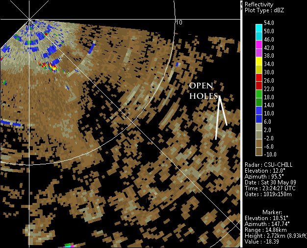
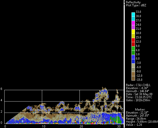
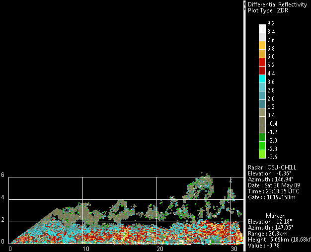
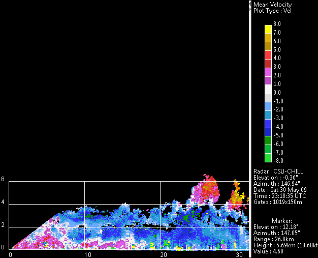
The combination of moisture gradients and | The combination of large moisture gradients and turbulent motions at the edges of developing cumulus clouds often generate refractive index structures that include size scales equal to one half of the viewing radar's wavelength. Bragg scattering from these structures can generate detectable radar echoes. Since the moisture gradients are highest near the visible edges of the clouds, the Bragg scattering echoes from cumulus clouds typically appear as open holes in PPI scans, and "inverted cups" in RHI scans. The following CSU-CHILL images show examples from a late May afternoon when cumulus clouds were actively developing into scattered thunderstorms. The isotropic scatter from the Bragg structures yields ~0 dB Zdr values; much more positive Zdr is found in the boundary layer due to the presence of insects flying with their long axes generally horizontally oriented. Indications of radial velocity divergence are present in the tallest developing cumulus top near 27 km range. Note: A finer resolution reflectivity color scale is used in the RHI plots. | ||
[[Image:30may2009 AI cu cup ppi z.png|center]] | |||
[[Image:30may2009 cu cup rhi z.png|center]] | [[Image:30may2009 cu cup rhi z.png|center]] | ||
[[Image:30may2009 cu cup rhi zdr.png|center]] | [[Image:30may2009 cu cup rhi zdr.png|center]] | ||
[[Image:30may2009 cu cup rhi v.png|center]] | [[Image:30may2009 cu cup rhi v.png|center]] | ||
Latest revision as of 16:30, 7 April 2020
The combination of large moisture gradients and turbulent motions at the edges of developing cumulus clouds often generate refractive index structures that include size scales equal to one half of the viewing radar's wavelength. Bragg scattering from these structures can generate detectable radar echoes. Since the moisture gradients are highest near the visible edges of the clouds, the Bragg scattering echoes from cumulus clouds typically appear as open holes in PPI scans, and "inverted cups" in RHI scans. The following CSU-CHILL images show examples from a late May afternoon when cumulus clouds were actively developing into scattered thunderstorms. The isotropic scatter from the Bragg structures yields ~0 dB Zdr values; much more positive Zdr is found in the boundary layer due to the presence of insects flying with their long axes generally horizontally oriented. Indications of radial velocity divergence are present in the tallest developing cumulus top near 27 km range. Note: A finer resolution reflectivity color scale is used in the RHI plots.


