WXlog/20061220 Blizzard
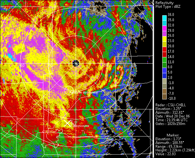
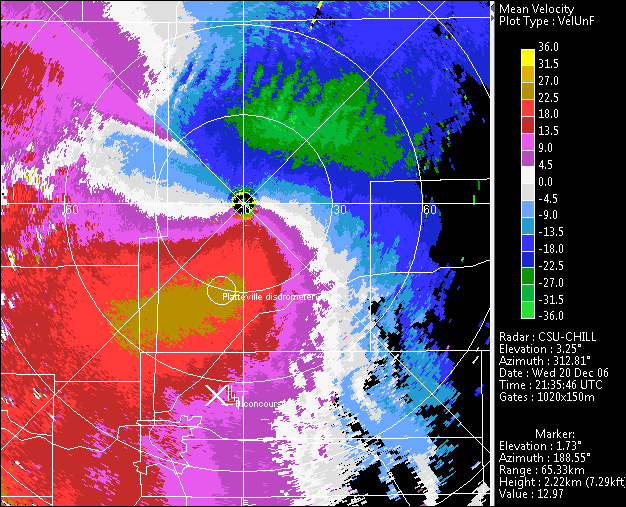
At 2137 UTC on 20 December 2006 Denver International Airport (KDEN) closed for the first time in the facility's history. (The airport opened on 28 February 1995). According to the Denver Post, at the time of the airport closure, the airfield was experiencing white out conditions with zero visibility and 40 MPH winds, making the continuation of snow clearing activities impossible. NWS METAR observations at 2153 UTC reported snow depth increasing at 1 inch per hour with 11 inches of snow on the ground. The following PPI images show the CSU-CHILL reflectivity data at the 1.7 degree elevation angle at essentially the airport closure time. (The higher value shown as the elevation angle in the lower right annotation is due to the antenna's motion towards the next higher sweep. This transition is also apparent in the echo discontinuities near the 310 degree azimuth.) The cursor is positioned at 189 degree at 65 km, just west of the airport. It marks a snowband that had recently crossed the airport while moving towards the west. Small scale wave patterns are apparent in the strong inbound (negative sign) radial velocities to the north-northeast of the radar.

