WXlog/20010711 Severe Gust Front: Difference between revisions
From CSU-CHILL
Pat kennedy (talk | contribs) (Created page with "A severe thunderstorm moved from the southwest over the city of Greeley as well as the CSU-CHILL radar site. The Greeley area experienced both wind and hail damage. (SPC rep...") |
Pat kennedy (talk | contribs) No edit summary |
||
| Line 1: | Line 1: | ||
A severe thunderstorm moved from the southwest over the city of Greeley as well as the CSU-CHILL radar site. The Greeley area experienced both wind and hail damage. (SPC reports include ~100 ft trees uprooted in Greeley at 0240 UTC and 1.75 inch diameter hail at 0300 UTC). As the storm approached the CHILL site, the radar was shifted into an operating mode that provided 50 m range resolution. This mode provided finer resolution observations of the gust front structure. (This data collection scheme had been requested as a part of the 20hr project conducted by Profs. B. Lee and | A severe thunderstorm moved from the southwest over the city of Greeley as well as the CSU-CHILL radar site. The Greeley area experienced both wind and hail damage. (SPC reports include ~100 ft trees uprooted in Greeley at 0240 UTC and 1.75 inch diameter hail at 0300 UTC). As the storm approached the CHILL site, the radar was shifted into an operating mode that provided 50 m range resolution. This mode provided finer resolution observations of the gust front structure. (This data collection scheme had been requested as a part of the 20hr project conducted by Profs. B. Lee and C. Finley of the University of Northern Colorado.) | ||
[[Image:11jul2001 GF 50m ppi z.png|center]] | [[Image:11jul2001 GF 50m ppi z.png|center]] | ||
Latest revision as of 09:06, 24 March 2020
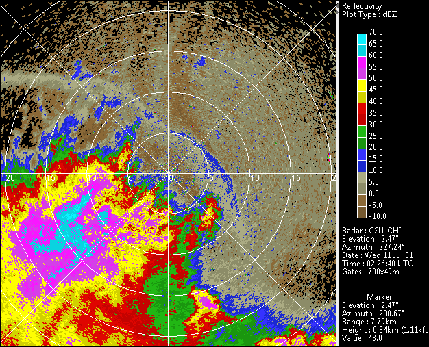
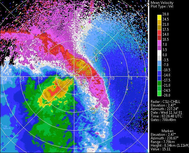
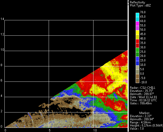
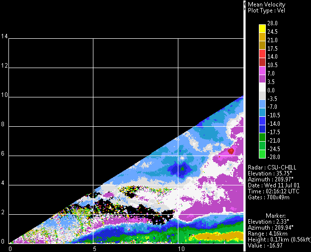
A severe thunderstorm moved from the southwest over the city of Greeley as well as the CSU-CHILL radar site. The Greeley area experienced both wind and hail damage. (SPC reports include ~100 ft trees uprooted in Greeley at 0240 UTC and 1.75 inch diameter hail at 0300 UTC). As the storm approached the CHILL site, the radar was shifted into an operating mode that provided 50 m range resolution. This mode provided finer resolution observations of the gust front structure. (This data collection scheme had been requested as a part of the 20hr project conducted by Profs. B. Lee and C. Finley of the University of Northern Colorado.)


