Time lapse photography of a cumulonimbus cloud: 2 July 2009
Introduction
Raindrops larger than ~1 mm in diameter tend to assume flattened equilibrium shapes. On average, the diameter of such drops is larger in the horizontal plane than in the vertical plane. Due to this preferred shape and orientation, raindrops typically cause positive differential reflectivity (Zdr) values to be observed by dual polarization weather radars. (Zdr is 10 log10(Zh / Zv), so it is positive when Zh > Zv and it is 0 dB when Zh = Zv). When raindrops freeze, they are no longer subject to flattening by aerodynamic forces; the resultant ice particles also tend to gyrate through a large range of spatial orientations. The combination of these factors acts to reduce the Zdr towards 0 dB as raindrops completely freeze.
Due to their mass, raindrops do not immediately freeze when subjected to sub 0C temperatures. One manifestation of this freezing delay can be the observation of positive Zdr columns in active cumulus cloud updrafts. Raindrops lofted in these updrafts may ascend a kilometer or more above the ambient 0C height before they completely freeze. This article presents selected CSU-CHILL radar observations that were made in a rapidly growing section of a cumulonimbus (CB) cloud system.
Digital Camera Photography
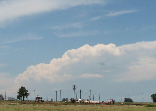
The following photographs were taken looking towards the northwest from the CSU-CHILL radar site during the early afternoon hours on 2 July 2009. The camera was adjusted to take a picture at 2 minute intervals. The range to the cumulonimbus cloud cluster is ~90 km.
|
|
||
|
RHI Scan Data
An upward RHI scan on an azimuth of 329 degrees ended at 2005:27 UTC, shortly before the exposure time of the seventh frame in the animation loop. This animation frame is shown below; the 329 degree azimuth intercepted a rapidly-growing cloud top area at 2006 UTC.


