Time lapse photography of a cumulonimbus cloud: 2 July 2009: Difference between revisions
From CSU-CHILL
Pat kennedy (talk | contribs) (added RHI plots) |
Pat kennedy (talk | contribs) |
||
| Line 3: | Line 3: | ||
<center> | <center> | ||
<imgloop delay=400 imgprefix="http://www.chill.colostate.edu/anim/2jul2009_CB_lapse/" width=520 height=370> | <imgloop delay=400 imgprefix="http://www.chill.colostate.edu/anim/2jul2009_CB_lapse/" width=520 height=370> | ||
f1a.JPG|1954 UTC | |||
f2a.JPG|1956 UTC | |||
f3a.JPG|1958 UTC | |||
f4a.JPG|2000 UTC | |||
f5a.JPG|2002 UTC | |||
f6a.JPG|2004 UTC | |||
f7a.JPG|2006 UTC | |||
f8a.JPG|2008 UTC | |||
f9a.JPG|2010 UTC | |||
f10a.JPG|2012 UTC | |||
</imgloop> | </imgloop> | ||
</center> | </center> | ||
==RHI Scan Data== | ==RHI Scan Data== | ||
[[Image:Dz 2jul09 web.png]] | [[Image:Dz 2jul09 web.png]] | ||
Revision as of 16:13, 28 December 2009
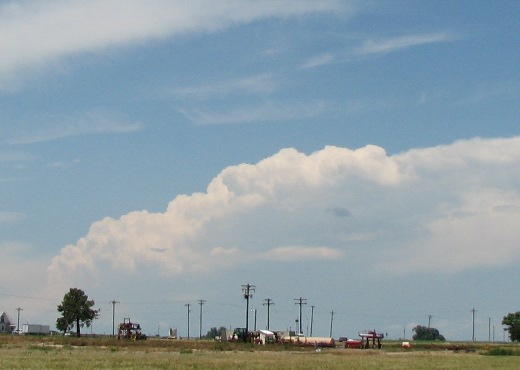
Digital Camera Photography
The following photographs were taken looking towards the northwest from the CSU-CHILL radar site during the early afternoon hours on 2 July 2009. The camera was adjusted to take a picture at 2 minute intervals. The range to the cumulonimbus cloud cluster is ~90 km.
|
|
||
|
RHI Scan Data


