Time lapse imagery of sky conditions near the Hewlett fire on 16 May 2012: Difference between revisions
From CSU-CHILL
Pat kennedy (talk | contribs) (Created page with "Camera pointed towards the NW from the CSU-CHILL site towards the Hewlett fire area on 16 May 2012. Images start at 2020 UTC and continue at 1 minute intervals for 90 minutes...") |
Pat kennedy (talk | contribs) No edit summary |
||
| Line 1: | Line 1: | ||
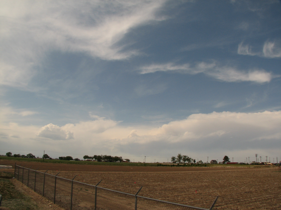
Camera pointed towards the NW from the CSU-CHILL site towards the Hewlett fire area on 16 May 2012. Images start at 2020 UTC and continue at 1 minute intervals | Camera pointed towards the NW from the CSU-CHILL site towards the Hewlett fire area on 16 May 2012. Images start at 2020 UTC and continue at 1 minute intervals through 2149 UTC. High-based CU and general southwesterly mid-level flow are apparent. Smoke layer is somewhat more visible when breaks exist in the intervening clouds. | ||
<center> | <center> | ||
Latest revision as of 10:06, 17 May 2012
Camera pointed towards the NW from the CSU-CHILL site towards the Hewlett fire area on 16 May 2012. Images start at 2020 UTC and continue at 1 minute intervals through 2149 UTC. High-based CU and general southwesterly mid-level flow are apparent. Smoke layer is somewhat more visible when breaks exist in the intervening clouds.
|
|
||
|