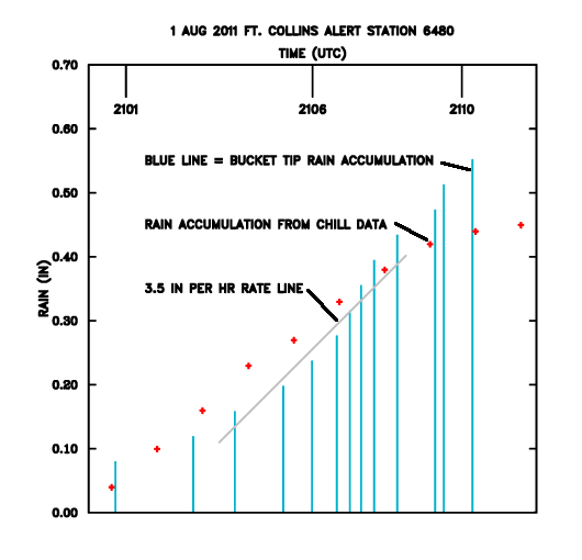
Thunderstorm outflow and rainfall near the surface over Ft. Collins: 1 August 2011
Introduction
On 1 August 2011 an isolated afternoon thunderstorm moved across the southern Fort Collins area. To obtain high time resolution observations of the near-surface portion of the storm, a series of four low elevation angle PPI sweeps were conducted through a narrow azimuthal sector. The resultant volume scans repeated on a 74 second cycle time, improving the sampling of the storm's low-level radial velocity and precipitation fields.
Divergent outflow
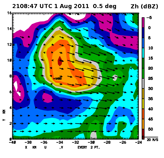
The downdrafts that characteristically occur during the mature stage of a thunderstorm spread out horizontally as they approach the surface. To visualize this flow pattern, vectors have been used to represent the radial velocity data collected in a 0.5 degree elevation angle PPI sweep. (The vectors are all aligned along radials from the radar; their length is proportional to the magnitude of the radial velocities. The X and Y axes are distances from the CSU-CHILL radar in km.) The diverging nature of the airflow was strong enough to induce outbound velocities on the far-range side of the echo core. The most intense inbound velocities were occurring on the eastern (leading edge) portion of the storm.
Intense rainfall rates
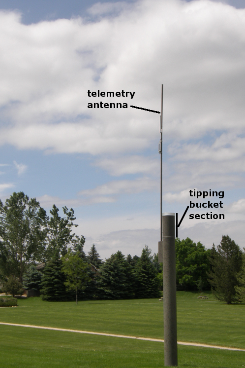
To monitor rainfall over several urban drainage areas, the city of Fort Collins operates a network of tipping bucket rain gauges. The occurrence of bucket tips is telemetered to a central monitoring site. The 1 August storm most directly affected gauge 6480 (pictured below):
The most intense reflectivities were observed over gauge 6480 at 2105:07 UTC. (Due to partial beam blockage at 0.5 degrees, 1.0 degree elevation angle data is shown in the following plot):
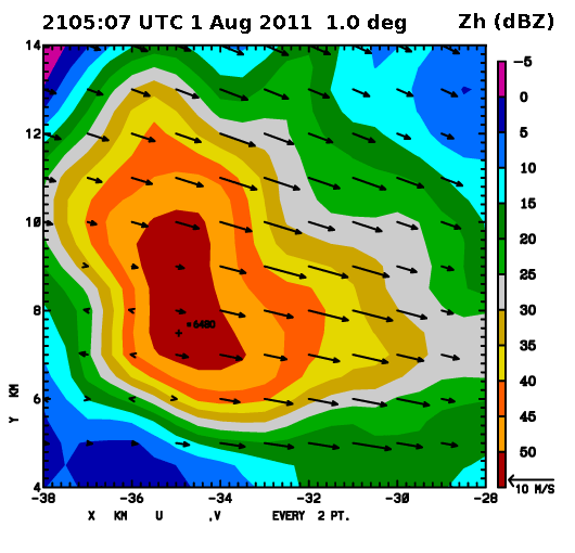
The specific differential propagation phase (Kdp) also maximized over the gauge at this same time. At the CSU-CHILL radar's 3 GHz operating frequency, Kdp value of 2.5 - 3 degrees per km imply rainfall rates of approximately 75 mm per hour (~3 inches per hour).
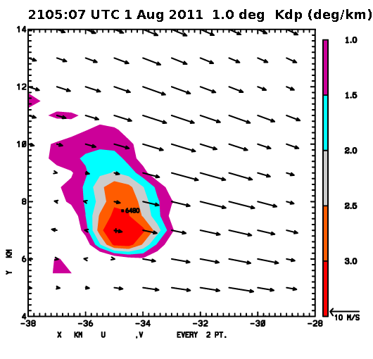
Radar - rain gauge comparison
