RHI scans through thunderstorm and snow echoes
Many operationally significant echo features exist within the lowest ~2km layer of the atmosphere. Under typical propagation conditions, the microwave pulses transmitted by meteorological radars will not follow the curvature of the Earth. Thus, the height of the center of the radar's beampath will increase with range, leaving the near-surface layer unobserved at longer ranges. (This basic limitation applies to both conventional single polarization as well as polarimetric weather radars.)
Some implications of this can be seen in the following annotated RHI scans through a thunderstorm:
The fine line echo marking the leading edge of the outflow is confined to the lowest height levels-
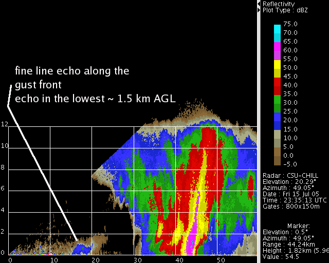
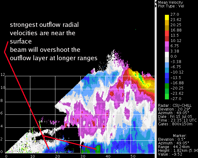
Due to its relatively high density, the cold air outflow from the storm maximizes near the ground. These shallow, strong outflows can seriously impact aircraft takeoff and landing operations. To improve their detection, the FAA Terminal Doppler Weather Radar systems are installed at fairly close ranges (within roughly 20 km) to the airports that they are protecting.
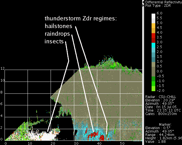
The differential reflectivity measurement made by dual polarization radars characterizes the reflectivity-weighted mean axis ratio of the scatterers. In this thunderstorm example, the most positive Zdr values (i.e., the most flattened particle shapes) are found in the echoes from the insects that have been concentrated by the convergent airflow along the fine line. Moderate (+2 to +3 dB) Zdr values are found where flattened raindrops exist. Near 0 dB Zdr's (i.e., equal power returns from the horizontally and vertically-polarized radar pulses) are seen from the randomly-oriented hailstones within the highest-reflectivity part of the precipitation shaft. These ~0dB Zdr values also exist through most of the sub-freezing depth of the thunderstorm. Thus, most of the Zdr field patterns in this example are also confined to the relatively near-surface height layer.
Snow also often poses another situation in which significant echo features are confined to low heights. The following slow scan rate RHI was taken along the axis of a snow band that was passing the CSU-CHILL radar site near Greeley, Colorado. Reflectivity tends to increase towards the surface as the particles grow in diameter through aggregation.
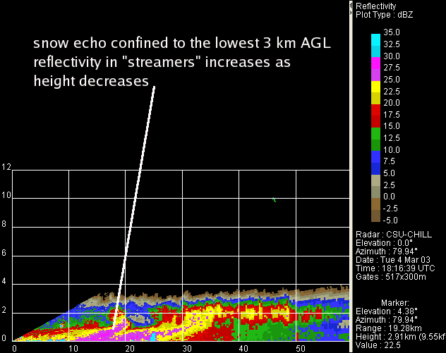
The "kinked" shape of the snow "streamers" develops as the particles descend from the upper levels where the radial velocities are positive (i.e., outbound) into the surface-based inbound flow. Due to these sloping snow trajectories, the surface locations of reflectivity maxima can differ from those observed at longer ranges / greater beam heights.
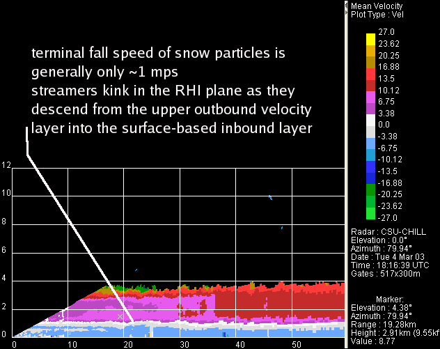
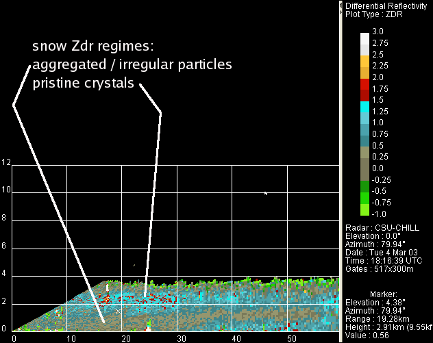
Snow echo systems often contain the Zdr stratification shown below. A layer of positive Zdr's is often found near the upper part of the echo mass where relatively pristine ice crystal habits predominate. As these particles collect into aggregates, the resultant clumps tend to have more nearly spherical cross-sections. Their bulk density also decreases and their orientation is space tends to become more random. The net result of these effects is a tendency for the Zdr to approach 0 dB where aggregation is underway in the streamers.
