RHI scans through thunderstorm and snow echoes
Many operationally significant echo features exist within the lowest ~2km layer of the atmosphere. Under typical propagation conditions, the microwave pulses transmitted by meteorological radars will not follow the curvature of the Earth. Thus, the height of the center of the radar's beampath will increase with range, leaving the near-surface layer unobserved at longer ranges. (This basic limitation applies to both conventional single polarization as well as polarimetric weather radars.)
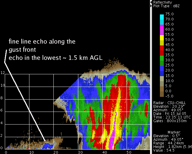
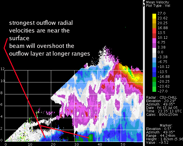
Some implications of this can be seen in the following annotated RHI scans through a thunderstorm:
The fine line echo marking the leading edge of the outflow is confined to the lowest height levels-

Due to its relatively high density, the cold air outflow from the storm maximizes near the ground. These shallow, strong outflows can seriously impact aircraft takeoff and landing operations. To improve their detection, the FAA Terminal Doppler Weather Radar systems are installed at fairly close ranges (within roughly 20 km) to the airports that they are protecting.
