File:CH 1.png
From CSU-CHILL

Size of this preview: 788 × 600 pixels. Other resolution: 871 × 663 pixels.
Original file (871 × 663 pixels, file size: 56 KB, MIME type: image/png)
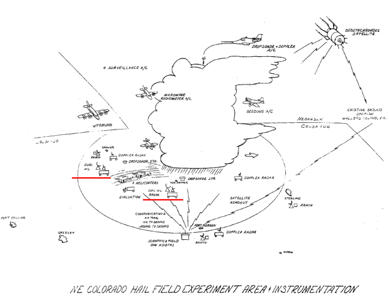
NHRE instrumentation sketch from the February 1969 preliminary planning document. The red underlines mark the locations of the two dual wavelength radars that were envisioned as being critical to the project. These radars were to be located near the towns of Grover and Ft. Morgan Colorado.
File history
Click on a date/time to view the file as it appeared at that time.
| Date/Time | Thumbnail | Dimensions | User | Comment | |
|---|---|---|---|---|---|
| current | 05:32, 8 August 2020 | | 871 × 663 (56 KB) | Pat kennedy (talk | contribs) |
You cannot overwrite this file.
File usage
The following page uses this file: