DPWX/Zdr evolution in snow showers: 26 October 2017: Difference between revisions
From CSU-CHILL
Pat kennedy (talk | contribs) No edit summary |
Pat kennedy (talk | contribs) (Adding front page material.) |
||
| Line 1: | Line 1: | ||
[[Image:26oct2017 2145 KCYS 0.5 deg ppi anot.png|300px|right]] | |||
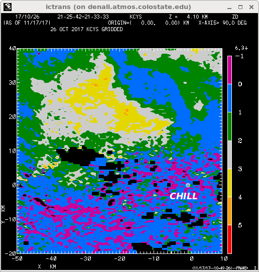
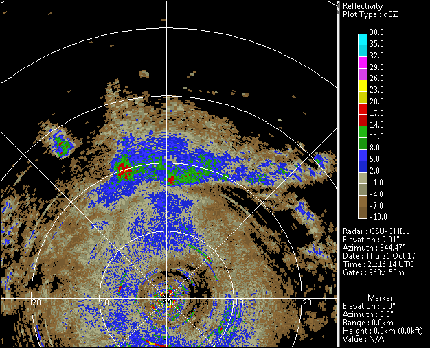
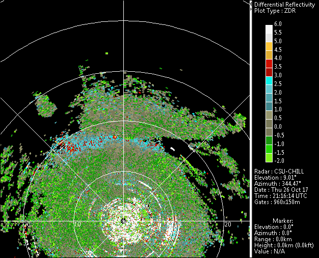
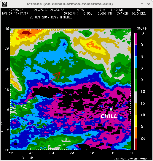
Showers, primarily snow, as seen in the reflectivity data collected by the NWS Cheyenne, WY radar in a 0.5 deg elevation scan on 26 October 2017. The CSU-CHILL radar collected continuous 9 deg elevation surveillance scans during this same time period. Differential reflectivity variations of several dB were observed in the snow showers near the CSU-CHILL radar. | |||
<center> | <center> | ||
<imgloop delay=100 imgprefix="http://www.chill.colostate.edu/anim/dec_2017_26oct2017_zdr/" width=640 height=512> | <imgloop delay=100 imgprefix="http://www.chill.colostate.edu/anim/dec_2017_26oct2017_zdr/" width=640 height=512> | ||
Revision as of 11:18, 22 November 2017

Showers, primarily snow, as seen in the reflectivity data collected by the NWS Cheyenne, WY radar in a 0.5 deg elevation scan on 26 October 2017. The CSU-CHILL radar collected continuous 9 deg elevation surveillance scans during this same time period. Differential reflectivity variations of several dB were observed in the snow showers near the CSU-CHILL radar.
|
|
||
|
|
|
||
|
|
|
||
|
|
|
||
|