DPWX/Tornadic supercell thunderstorm: 7 May 2016
CHILL 6.5 deg el PPI scan ending at 2039:31 UTC. BWER was present in storm of interest. Black dots at Empire Reservoir indicate approx locations where tornado damage (primarily to camping trailers) was found in the NWS post-storm survey.

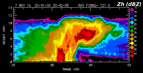
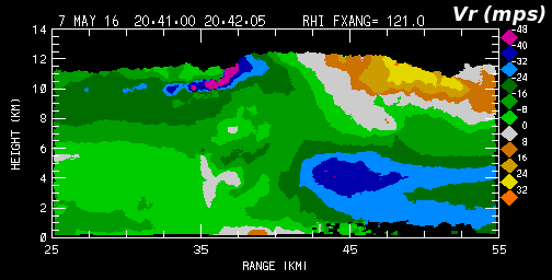
CHILL RHI scan at 2041 UTC through the BWER shown above. NWS issues tornado warning at 2046 UTC for radar indicated rotation 5 miles west of Wiggins, moving north at 35 mph.
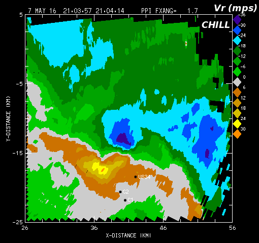
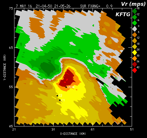
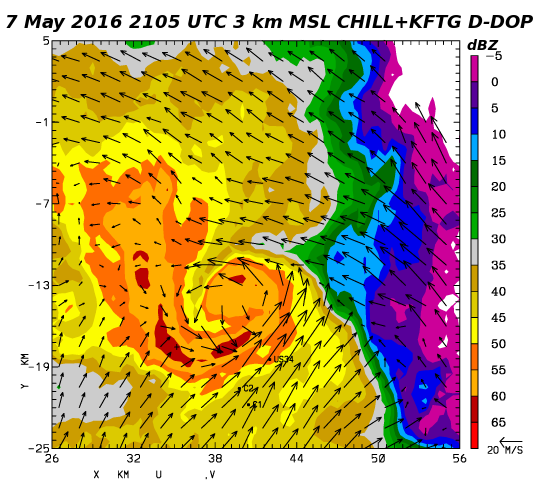
Next two plots show the low-level mesocyclone couplet as seen by CHILL and KFTG. For reference, the points marked C1, C2 and US34 bound the Empire Reservoir damage points. These two sweeps are part of the two volume scans that were processed in the dual-Doppler horizontal wind field synthesis shown below. (The CHILL volume started at 2103:40 UTC, the KFTG volume started at 2103:56 UTC).
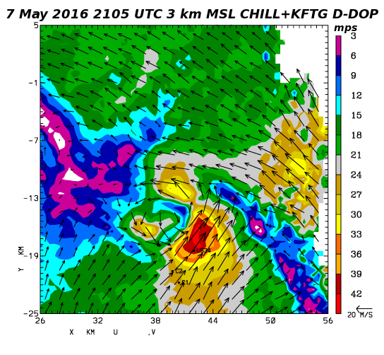
Earth-relative horizontal wind vectors and CHILL reflectivity data at the 3 km MSL height level. Analysis time is 2105 UTC.
Horizontal wind speed analysis based on the dual-Doppler U and V components. Three localized wind speed maxima were present in the mesocyclone region at this single time snapshot. Northward storm motion probably contributed to the maxima that contained the highest speeds (> 40 mps).
