DPWX/Descending melting level: 18 May 2017
Overview
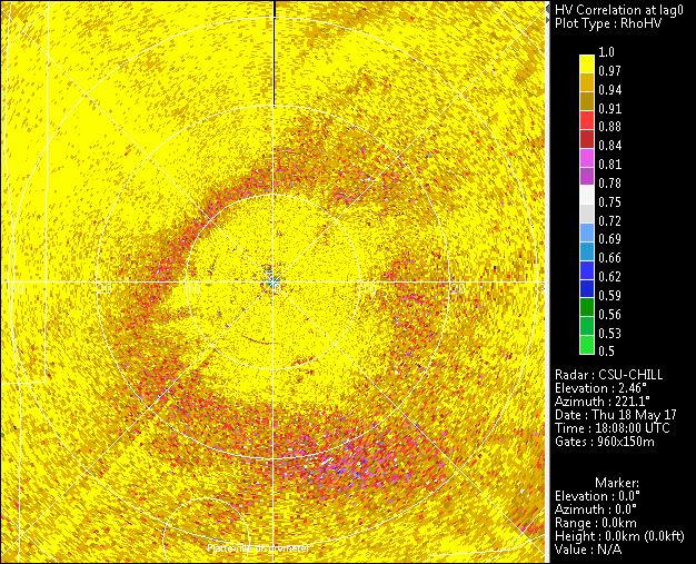
A significant late spring storm started affecting much of the CSU-CHILL radar coverage area during the morning hours 18 May 2017. Wet snow accumulated at the higher terrain elevations around Fort Collins (~XXX m MSL). At the slightly lower (1432 m MSL) CHILL radar site the precipitation was mostly rain until the mid to late afternoon hours (all of the above-mentioned times are local). The CSU-CHILL conducted 360 PPI scans during much of this event. The descent of the melting level towards the surface in the CHILL / Greeley area was observed in the co-polar correlation coefficient (RHoHV) dual polarization data field.
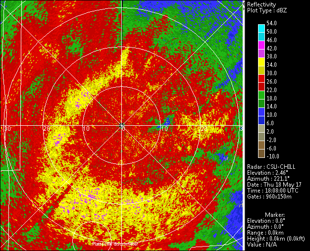
Reflectivity loop
The following loop shows the reflectivity data observed in the 1.7 degree elevation PPI scans. The time interval between the scans is slightly over 6 minutes. The organization of the high reflectivity features undergoes significant, rapid fluctuations. The presence of melting snow particles probably contributes to these localized reflectivity maxima. For example, at ~2000 UTC (frame #19), a drive in the area within 5 km to the northwest of the radar penetrated the transition from rain to wet snow.
|
|
||
|
RhoHV loop
|
|
||
|
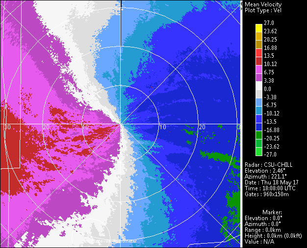
Radial velocity loop
|
|
||
|