Convective storm initiation: 9 August 2008
Introduction
Convergent airflows in the boundary layer often collect insects during the warm season. The resultant locally increased insect concentrations frequently produce echoes that are detectable by most operational weather radars. These linear boundary layer echo features are operationally significant since their associated convergence is often important to the initiation of thunderstorms (Wilson and Schreiber, MWR 1986). The images in this article give an example of thunderstorm development along a moving thin line echo.
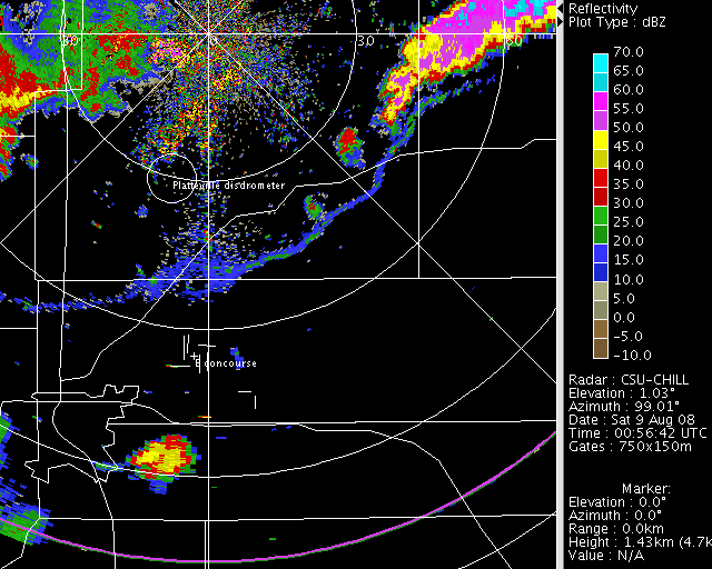
Reflectivity Loop
During the early UTC hours of 9 August 2008, a thin line echo that extended across several counties moved southward past the CSU-CHILL radar site. A cluster of severe thunderstorms was already present along this boundary approximately 50 - 60 km east of the radar at the start of the loop (0056 UTC). Over the course of the loop, the boundary continues moving to the south and helps intensify an area of storms over the Denver area. By the final portion of the loop, new storm development just behind the boundary results in an essentially solid arc of echoes near a range of 90 km in the southeast azimuth quadrant of the CSU-CHILL radar.
|
|
||
|
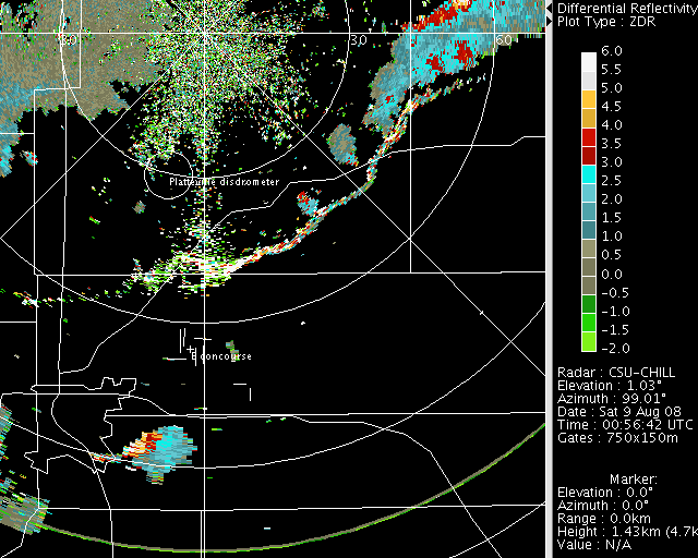
Differential Reflectivity Loop
On average, the differential reflectivity levels observed along the thin line echo tended to be more positive than those seen in the thunderstorm rain areas. (Note: Zdr values above +9 dB "fold" into negative (green) colors in this data.) The highly oblate shapes of insects (in comparison to raindrops) commonly produce these distinctly positive Zdr magnitudes.
|
|
||
|
RHI Data
The propagating boundary helped promote the development of intense thunderstorms over the eastern portions of the Denver area. The following plot shows the location of an RHI scan that was done at 0153 UTC.

In the RHI plot, selected specific propagation phase (Kdp) contours have been plotted over the reflectivity field. A Kdp value of 3 deg / km indicates that rain rates exceeded 100 mm /hr. (The NWS did issue a flash flood warning for parts of Denver and Aurora due to the locally heavy rain produced by this storm.)

The radial velocities seen in the RHI sweep contain a strongly divergent pattern near the top of the echo. Divergence is also indicated at low levels in association with the intense rain core.
