Cold frontal passage: 3 October 2012
Introduction
A strong cold front passed the CSU-CHILL radar site at 1600 MDT / 2200 UTC on 3 October 2012. No surface precipitation was associated with the frontal passage at the radar. Small areas of virga and weak rain showers were visible primarily to the south of the radar during the hour after windshift associated with passage of the front. PPI scan volumes composed of 4 low elevation angles that repeated on an ~5 minute interval were run as the front passed the radar.
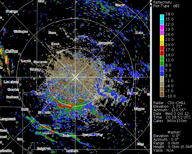
Reflectivity loop
The following image sequence was made from the 1.0 degree elevation sweeps. The Greeley area produces a distinctive region of clutter return within 15 km range in the southwest azimuth quadrant. This clutter echo strengthened as the curvature of the radar beam towards the ground increased due the temperature inversion that developed in association with the invading cold (and more moist) airmass.
|
|
||
|
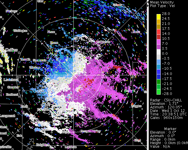
Radial velocity loop
Surface winds were approaching the radar from the northwest prior to the frontal passage. The wind direction shifted to the northeast and increased in strength behind the front.
|
|
||
|
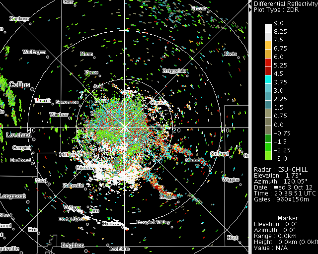
Differential reflectivity
Localized areas of positively-enhanced differential reflectivity values were observed at several times as the front progressed through the region. These appeared to have some association with pre-existing areas of distinctly positive Zdr values within the general boundary layer echo that were collected by the horizontal convergence in the frontal band. These large (~5 dB and greater) Zdr values are typically associated with the backscatter from flying insects.
|
|
||
|
Conclusion
Detailed information on the location and movement of cold airmass boundaries can be obtained by Doppler weather radars when suitable "clear air" scatterers are available. Such observations can be useful for nowcasting purposes, particularly at discrete locations such as airports, large outdoor gatherings, etc.