Cell intensification following a boundary passage: 30 August 2013
Introduction
During the late afternoon hours of 30 August 2013 the CSU-CHILL radar conducted 360 surveillance PPI volumes composed of two elevation angles: 0.75 and 1.25 degrees. These volumes repeated on an ~1.5 minute cycle providing high time resolution observations of the interactions between several boundary layer echo features and some evolving showers located to the east of the radar. The storm of interest was located approximately 30 km southeast of the radar as a fine line echo approached it from the north-northeast at 2329 UTC. The following plot shows the reflectivity data observed in the 1.25 deg elevation S-band data:

The radial velocity patterns indicated that localized convergence was present along the fine line echo. (This is most evident along the

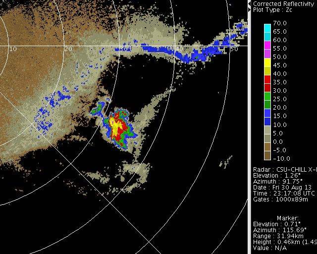
Attenuation-corrected reflectivity X-band loop
The radar was operating in dual frequency mode during this operation. Due to the narrow (0.3 deg) beamwidth, the X-band data provides a high spatial resolution view of the echo evolution. The following loop of attenuation-corrected X-band reflectivity data shows that several fine line echoes
|
|
||
|
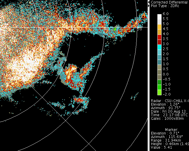
Differential attenuation-corrected Zdr loop
|
|
||
|
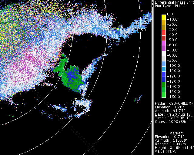
Differential propagation phase loop
|
|
||
|
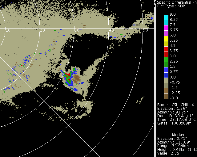
Specific differential propagation (Kdp) loop
|
|
||
|