WXlog/20040805 Heavy Rain
From CSU-CHILL
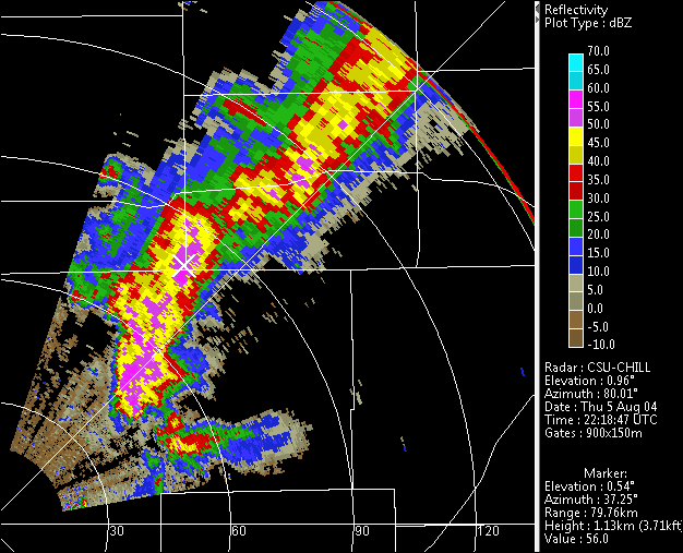
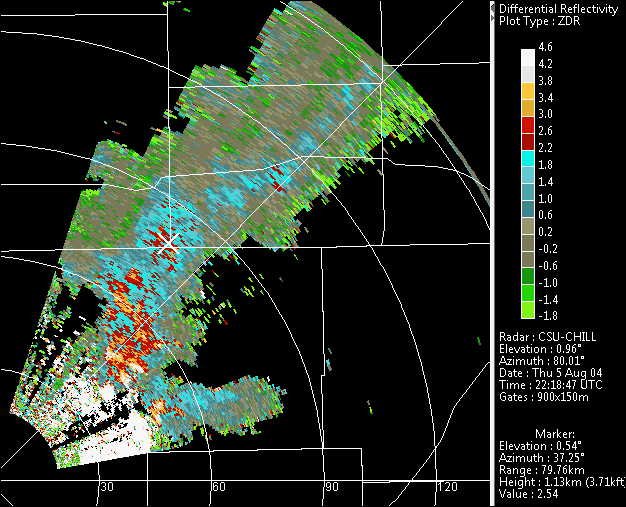
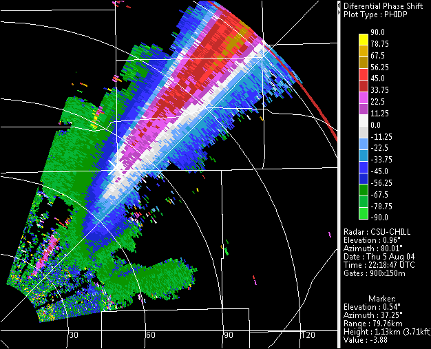
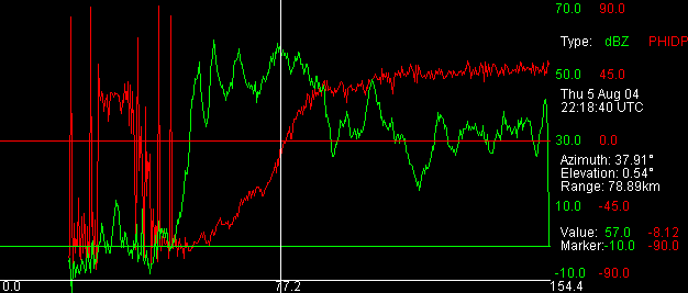
Thunderstorm activity became somewhat aligned with a northeast radial of the CSU-CHILL radar. The resultant long beam path through heavy rain containing significant concentrations of oblate raindrops caused a differential propagation phase accumulation of ~135 degrees. The red trace in the final A-scope plot shows the phidp levels increasing from an initial level of ~ -90 degrees up to ~ +45 degrees in the more distant ranges. This A-scope is on the azimuth marked by the cursor in the PPI plots; the cursor range is marked by the vertical white line in the A-scope plot.


