Negative Kdp observations in the upper portion of a thunderstorm on 20 June 2008
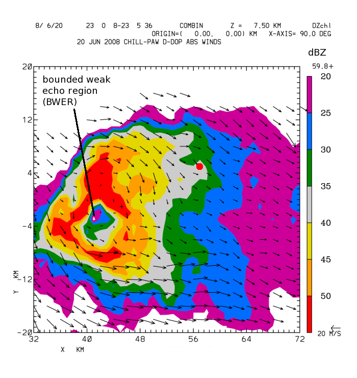
During the afternoon of 20 June 2008, synchronized PPI sector volume scans were done by the CSU-CHILL and Pawnee radars in the course of test operations of the new CHILL offset feed antenna. The volume scans started at 2300 UTC were centered on a severe thunderstorm located ~40 km east of Greeley. The plot below shows the dual-Doppler, Earth-relative horizontal wind field vectors at a height of 7.5 km MSL. The color-filled contours are the CHILL radar reflectivity levels. A well defined Bounded Weak Echo Region (BWER) was present at the analysis height:
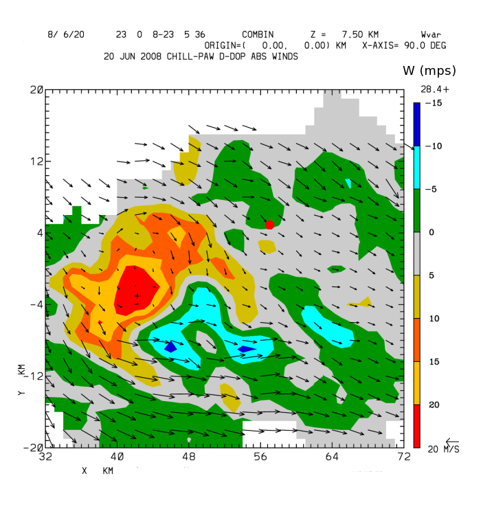
The associated dual-Doppler vertical air motion field at 7.5 km MSL is contoured in the following plot. An updraft maximum on the order of 20 mps was well correlated with BWER location. Previous studies have demonstrated that such strong updrafts raise the primary precipitation growth area to relatively high altitudes, leaving a weak echo region at lower heights (see for example, Knight et al., MWR 2008, p 2833).
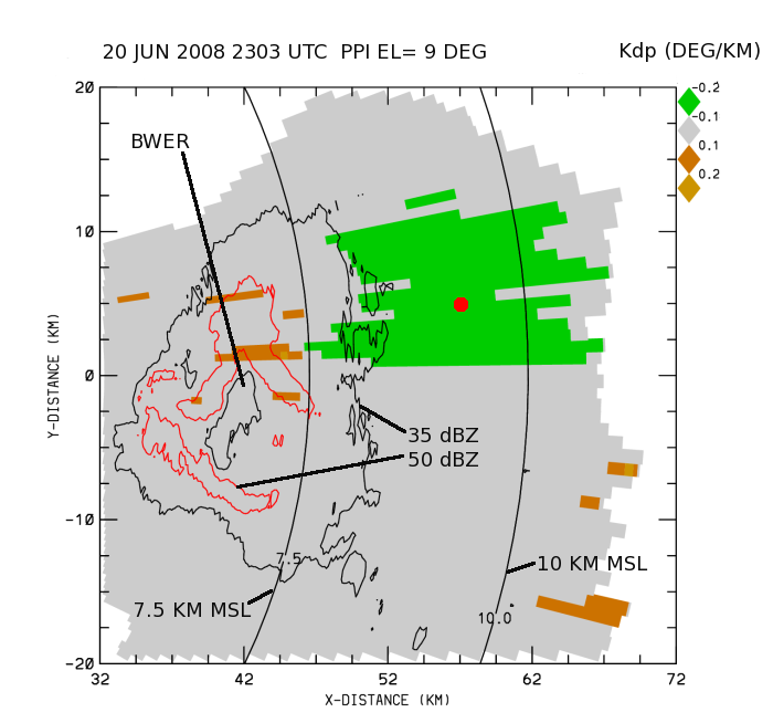
The final plot is derived from the 9 degree PPI sweep that was included in the CSU-CHILL volume scan. The color fill in this plot is specific propagation differential phase field (Kdp) in degrees / km. (To aid in registration with the dual Doppler CAPPI plots, selected reflectivity contours have also been included.) The 9 degree PPI sweep contains a large region of negative Kdp values in the lower reflectivity anvil echo region located northeast of the updraft. (A large red dot indicating the approximate center of the negative Kdp area is shown in all three plots at X=57, Y=5 km from the origin at the CHILL radar site.) These negative Kdp values develop when the hydrometeors have become oriented such that their long axes are approximately in the vertical direction. Ice crystals can assume this vertical orientation when they are subjected to a suitably strong electric field. Metcalf (JAM 1995, p 757) has shown that the development and disappearance of negative Kdp areas can be used to remotely sense the electrification characteristics of the upper portions of thunderstorms.


