WXlog/20050511 PPI echo overhang
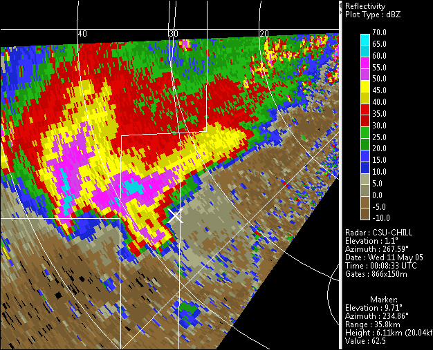
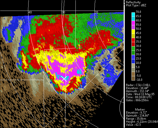
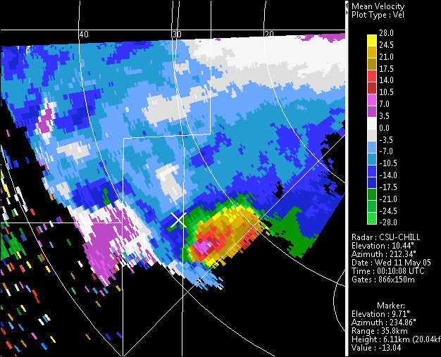
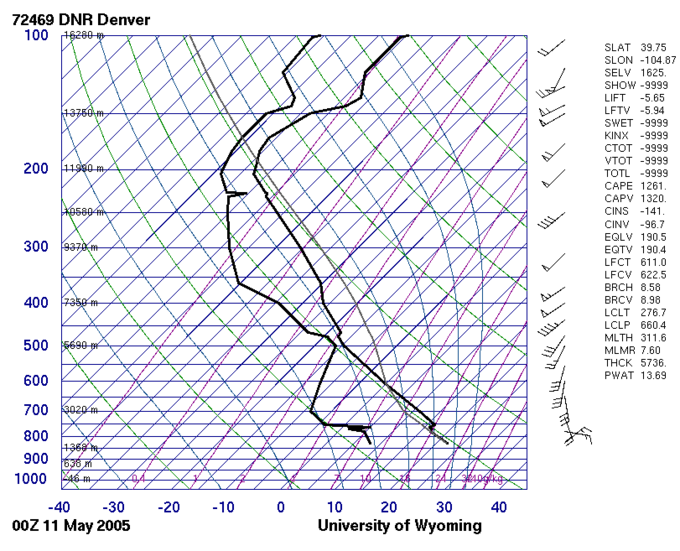
According to SPC storm reports, a severe thunderstorm left a hail swath from Longmont to Greeley. The SPC report from Longmont at 2350 UTC also noted that the storm appeared to be rotating. Hailstones with maximum diameters of 0.75 - 1.0 inches fell during the storm passage at the CHILL radar site. The first PPI scan shown below presents the storm's reflectivity structure at near-surface heights. The second scan is from approximately 10 degrees elevation in the same volume scan. The cursor marks a reflectivity maximum in the upper level scan. This same cursor location is ahead (NE) of the sweep one echo core in the first plot. This vertical echo displacement is indicative of a strong updraft that is supporting the overhanging echo. The 10 degree elevation angle radial velocity plot shows significant folding in the inbound flow around the right flank of the storm. This right flank acceleration is related to local, dynamically-induced pressure perturbations that develop in association with thunderstorms that become organized in an environment with sufficient instability and a wind profile that veers and strengthens with height. The final plot of the Denver sounding data shows that this type of "rotating thunderstorm" environment was present at 00 UTC on 11 May 2005.


