Outflow surge from an area of thunderstorms: 8 July 2010
During the late afternoon hours of 8 July 2010, the low level ambient winds were from the west-southwest in the vicinity of the CSU-CHILL radar site at Greeley. An area of thunderstorms developed along a north-south axis centered 40 km east of the radar. The ambient winds thus opposed low level outflow on the western side of the thunderstorm complex. As evidenced by the motion of a fine line echo, outflow from the thunderstorm complex was able to make westward progress around the time when the radar-indicated rain rates in the thunderstorm area maximized.
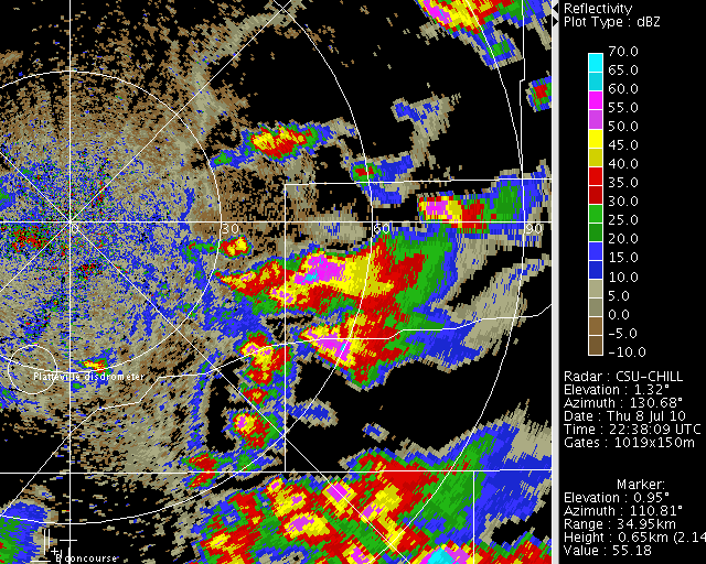
Reflectivity loop
The following reflectivity loop was made from 1.3 degree PPI scans made at time intervals of slightly more than 4 minutes. The fine line echo located between the intense thunderstorm precipitation and the radar site marks the western edge of low level outflow from the storms. After a period of unsteady motion, the fine line accelerates towards the radar in the later portion of the loop.
|
|
||
|
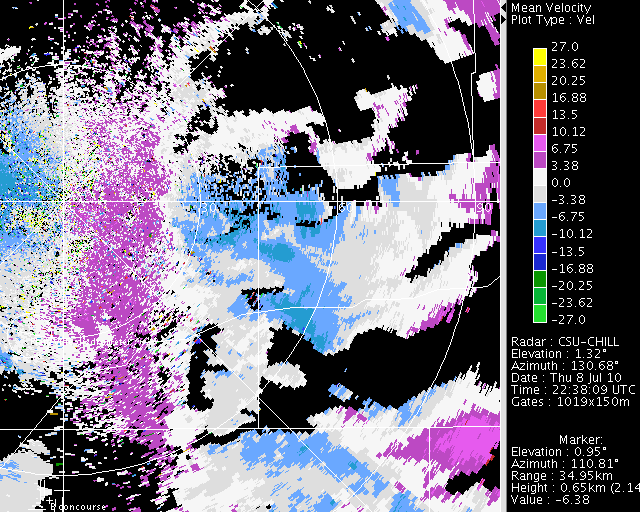
Radial velocity loop
A convergent radial velocity pattern was evident along the fine line. Westward motion of the line was related to maximizations in the negative (radially towards the radar) velocity regime in the thunderstorm outflow area.
|
|
||
|
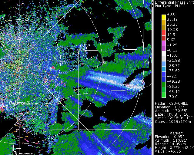
Differential propagation phase loop
During passage through areas with high concentrations of oblate raindrops (characteristic of heavy rainfall), the propagation of the horizontally-polarized radar pulses becomes retarded relative to that of the vertically-polarized pulses. The differential propagation phase field shows the phase difference in degrees between the received H and V signals. In the following plots, range intervals where the color values move rapidly upscale (i.e., the H phase is most rapidly losing ground relative to V) indicate intense rain rates. These heavy rain indications can be seen at several locations in the thunderstorm complex. The heavy rain areal coverage appears to maximize in the general 2320 - 2355 UTC period. The westward acceleration of the fine line began in concert with this high rainfall period.
|
|
||
|
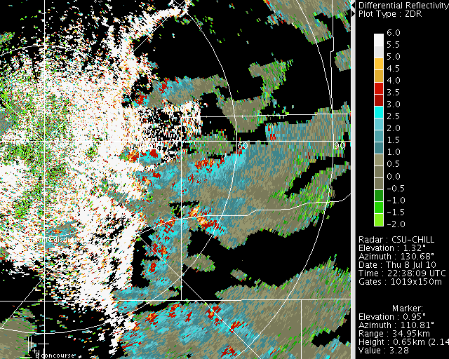
Differential reflectivity () loop

Positive values were evident in association with the high rain rate areas. The large drop diameters in these areas assume oblate equilibirum shapes. These flattened shapes cause the reflectivity measured at H polarization to exceed the reflectivity level measured at V polarization. Since is based on the ratio; large raindrops will produce positive values.

|
|
||
|