Hail Storm Near Denver International Airport on 20 June 2001
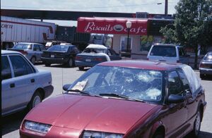
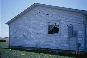
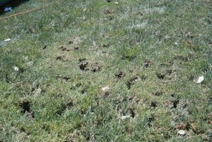
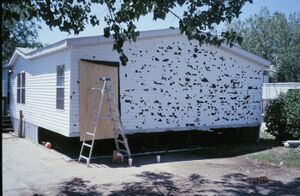
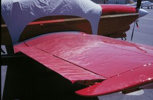
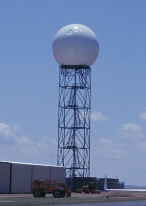
Between 7 and 8 PM local time on Wednesday, 20 June 2001, a severe thunderstorm with large, damaging hail struck the Denver International Airport vicinity. This event was observed by the 11 cm wavelength, dual polarization CSU-CHILL radar. This web page provides some selected views of the radar data as well as some post-storm hail damage photographs.
Radar Observations
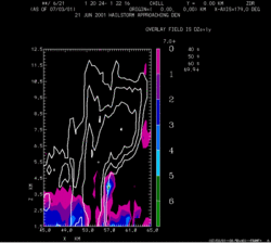
An RHI scan was taken on an azimuth of 179 degrees at 0121 UTC (1921 MDT). The basic radar data have been interpolated to a Cartesian grid via REORDER and plotted using CEDRIC. At 0121 UTC the storm was still approximately 12 km north of the center of Denver International Airport (DEN). Two inch diameter hail was reported in the town of Lochbuie near this same time. (Lochbuie is ~ 10 km west of the RHI plane). Reflectivity contours are plotted in white from a starting level of 40 dBZ. The echo core reflectivity pattern displays the elevated forward overhang structure that typically results from strong updrafts. DIfferential reflectivity (ZDR) values are plotted as a color fill pattern from a starting value of 0 dB. The tumbling, disoriented hailstones in the echo core contribute to quasi-equal H and V polarization returned powers, and thus near-zero dB ZDR values. This is in contrast to the positive ZDR's generated by the oblate cross sectional shapes of falling raindrops. The simultaneous occurance of high reflectivities and ~0 dB ZDR's is a well known polarimetric radar hail signature. The isolated patch of large positive ZDR's centered aloft at X=57.4 km and Z=4 km may be an artifact due to three body scattering.
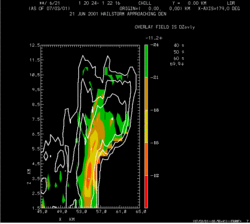
The next figure combines the reflectivity and Linear Depolarization Ratio (LDR) fields from the same RHI sweep. Significantly large depolarization levels (greater than ~ -24 dB) are present in much of the 50 dBZ echo region. This enhanced depolarization area extends several km above the -10 C ambient temperature height. (5.7 km MSL based on the 00 UTC DNR sounding). These high depolarization levels aloft are probably due to enhanced cross-polar backscattering from hailstones growing in an environment with a large supercooled liquid water content.
PPIs around DEN
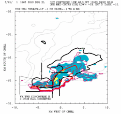
This figure shows a 0.5 degree elevation angle PPI scan taken as the storm crossed DEN at 0131 UTC (1931 MDT). The basic radar data were interpolated to a Cartesian grid on the PPI surface using the NCAR SPRINT program. The echo core was characterized by an extensive area of >60 dBZ reflectivities. ZDR values below 0 dB and -1 dB are shown by blue and yellow color shading respectively. Negative ZDR values result when the vertically polarized reflectivity is greater than the horizontally polarized reflectivity. This negative ZDR characteristic has been observed by the CSU-CHILL radar in other major hailstorms. The radar's ZDR calibration error on 6/20 is thought to be less than 0.2 dB. LDR values are shown by red contours. Much of the echo core region is contained within the -15 dB LDR contour; a notably large depolarization level for S-band radar observations. Two inch diameter hail was observed at DEN at 0133 UTC. Significant hail damage to both aircraft and automobiles was reported at the airport.
PPIs around trailer park
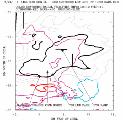
This Figure shows another 0.5 degree PPI scan taken at 0145 UTC (1945 MDT) as the storm approached I-70. The leading edge of the echo core began to take on an outwardly-bulged shape around this time. Radial velocity magnitudes greater than 10 mps are shown with color contours. A mesoscale cylonic circulation is indicated along the leading edge of the storm: Outbound (positive) velocities in excess of 30 mps were present just south of Watkins. Negative (inbound) velocities were found ~7 km farther to the east.
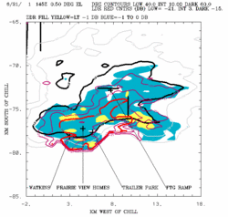
Next, the polarimetric data from the same PPI sweep. As in the previous figure, the intense echo core continued to be characterized by zero (or somewhat negative) ZDR values, and LDR levels that frequently exceeded -15 dB.
Damage Survey
A damage survey was conducted in the greater Watkins area on the day after the storm.
Acknowledgements
Data collection by the CSU-CHILL radar would be impossible without the technical support of Dave Brunkow (Chief Engineer) and Bob Bowie (Master Radar Technician). The 35 mm damage survey photographs were scanned into digital images by Jeff Lemke at the CSU CIRA complex.
Pat Kennedy 5 July 2001.
