Differential echo motions: 24 June 2005

Areas with opposite-sign radial velocities were observed in separate regions of a thunderstorm complex on 24 June 2005. PPI image loops show the development of a meso-scale anticyclonic motion within this echo area.
Introduction
During the afternoon hours of 24 June 2005, the CSU-CHILL radar conducted high time resolution (~1:25 repetition interval), low elevation angle PPI sector scans that covered a nearby cluster of thunderstorms. Time lapse animation of the reflectivity data showed the development of distinct clockwise rotation pattern within the echo complex.
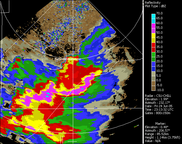
Reflectivity data
The development of the meso-scale rotation pattern apparently was aided by the effects of a northeastward-moving fine line that impacted the western portion of the echo system. In contrast, the reflectivity cores located in the eastern section of the echo area only drifted slowly away from the radar. The following image shows the highlights of the situation. The range rings are at 30 and 60 km.

|
|
||
|
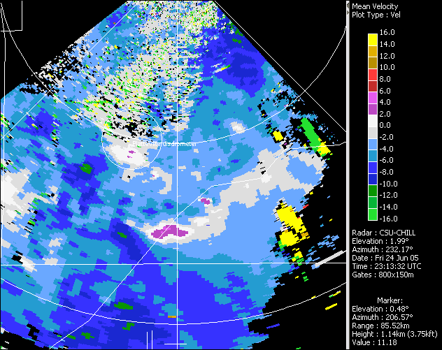
Radial velocity data
The enhanced inbound radial velocities associated with the propagating fine line are apparent in the following image. The odd-looking velocity patches embedded in the southeastern portion of the echo field are second trip returns from the upper portions of thunderstorms located at ranges beyond 150 km.

|
|
||
|
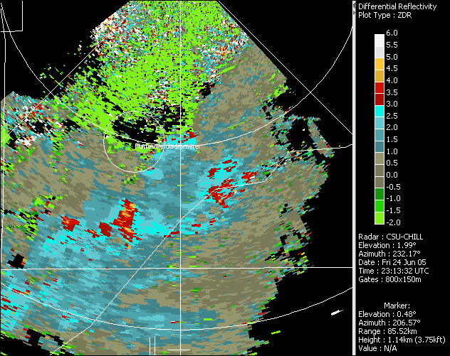
Differential reflectivity data
The insects collected in the convergent airflow along the fine line produce large positive magnitudes. Due to this characteristic pattern, warm season fine lines are often easiest to identify by examining the low elevation angle data. The returned by ground clutter targets is commonly negative in sign:


|
|
||
|