DPWX/Low level convergence in dual-Doppler winds: 7 May 2016
Author: Patrick C. Kennedy
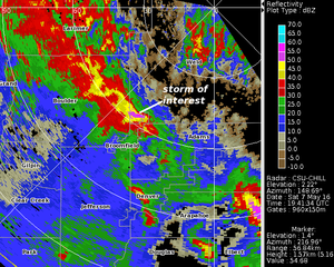
A small thunderstorm that affected the Broomfield, Colorado area during the early afternoon hours of 7 May 2016 is seen in the reflectivity data collected in a low elevation angle CSU-CHILL PPI scan. Horizontal winds synthesized from CHILL and KFTG radial velocity data showed well-defined convergence at near-surface levels in the vicinity of this thunderstorm.
Overview
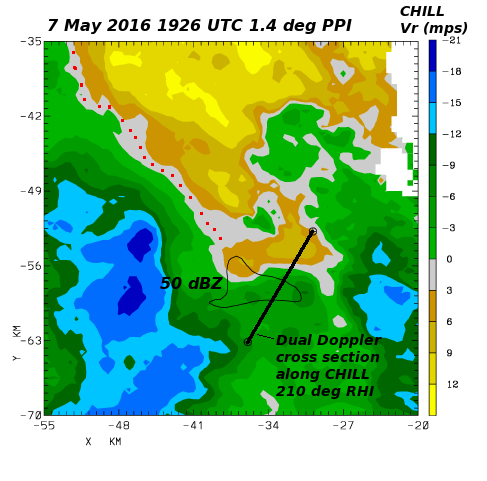
On 7 May 2016 an approaching synoptic scale trough was forecast to produce afternoon thunderstorms across much of northeastern Colorado. At low levels, a moist easterly flow regime was in place in much of the CSU-CHILL coverage area when radar operations began around mid-day. By approximately 1900 UTC, thunderstorms began to develop to the south of the radar. The following plot shows the radial velocity data observed in a 1.4 degree elevation scan that covered a small thunderstorm located approximately 60 km southwest of the radar. The black 50 dBZ contour shows the location of the thunderstorm reflectivity core. The red dots highlight the highly convergent characteristics of the low level wind field in much of the thunderstorm environment. (i.e. the zero radial velocity contour is oriented perpendicular to the radar azimuths with outbound (positive) values on the near-range side.)
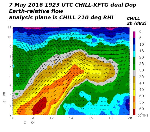
Dual Doppler winds in the 1923 UTC RHI scan
The CHILL radar did a two-sweep RHI scan through the thunderstorm at 1923 UTC. This scan time overlapped the later portion of a volume scan that the NWS KFTG radar started at 1919:21 UTC. The radial velocities from these two radars were interpolated to a common Cartesian grid with the positive Y direction aligned with true North. Three dimensional wind components were synthesized from the gridded data using the NCAR CEDRIC software. These analysis results were then re-mapped onto a vertical surface that coincided with the CHILL RHI scan plane. (The location of this analysis plane is marked in the PPI plot that was shown above.) The vertical cross section shown below contains an organized updraft associated with the low-level convergence zone. The combination of the updraft and the strengthening southwesterly synoptic flow aloft produced an overhanging reflectivity structure.
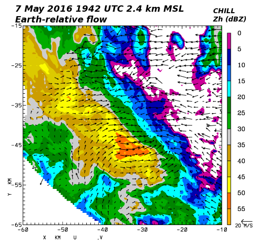
Dual Doppler winds at 1942 UTC
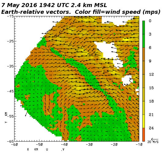
A second CHILL - KFTG dual Doppler synthesis as done ~19 minutes later at 1942 UTC. In this case, the CSU-CHILL data came from a PPI sector scan volume, allowing a more complete mapping of the low-level horizontal wind field to be done. The vectors in the following plot show the the Earth-relative horizontal wind field at the 2.4 km MSL (~900 m AGL) height level. At this time and height level, the convergence zone continued to exist along a north-northwest - south-south east line located just to the east of the thunderstorm. Wind directions were in essentially direct opposition in the vicinity of this convergence line.
The color-fill in the next plot shows the magnitude of the horizontal winds that were synthesized in the 2.4 km MSL dual-Doppler analysis. (For reference with the previous plot, the same velocity vectors are included.) The convergence line coincides with a zone of relatively low (less than 6 mps) wind speeds.
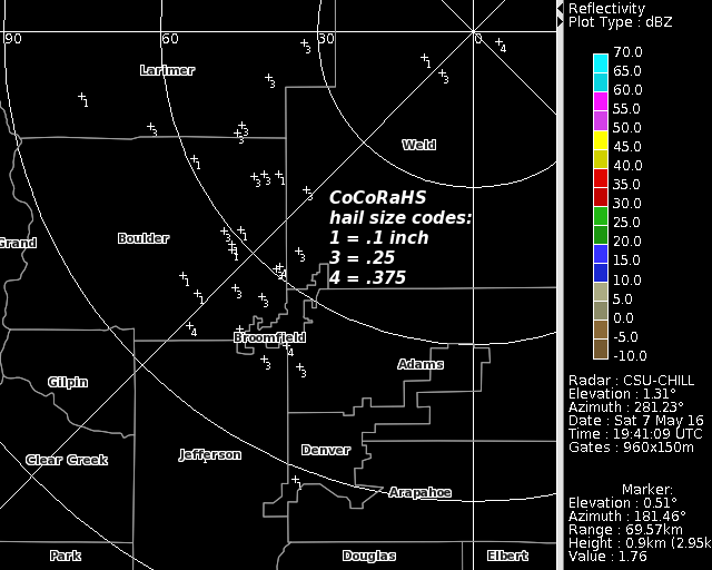
Hail reports from the CoCoRaHS observing network
The final plot shows the locations of Community Collaborative Rain, Hail, and Snow (CoCoRaHS) observers who reported hail from this thunderstorm. The reported hail diameters (in inches) are shown by the single digit numerical codes. While the storm generated many reports of hail, the largest diameters were only .375 (3/8) inches; well short of the one inch diameter threshold that the NWS uses to identify severe hail. These small hail diameters may have been related to the cold surface temperatures that reduced the buoyancy of the air that was supplying the thunderstorm's updraft. A special surface weather observation taken at the Rocky Mountain Metropolitan Airport (KBJC) at 1913 UTC gave a surface temperature of +8 C (46.4 deg F). This observation also indicated that the present weather was a thunderstorm producing heavy rain and small hail (3/4SM +TSRA GS). (KBJC is located along the southwestern edge of Broomfield county).
Acknowledgments
Noah Newman of the CoCoRaHS staff provided the hail reports from 7 May 2016.